
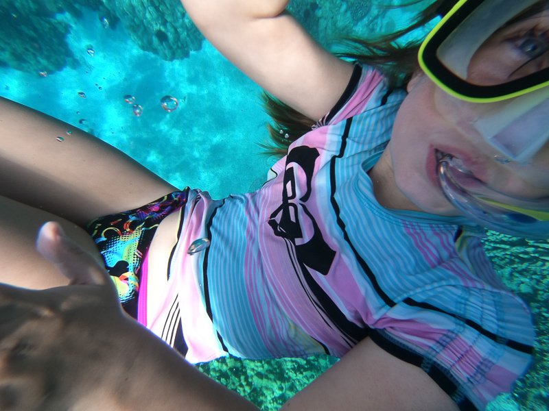
My Daughter’s Description of Our Snorkeling Day Trip in Hawaii
My Daughter’s Description of Our Snorkeling Day Trip in Hawaii
We wake up and get ready. I’m really excited, my mom looks happy, and my dad shows a straight face. I dunno if he is happy or not. We have “breakfast”: It’s not even true breakfast as we are just having a little snack to satisfy our hunger!
We grab our things and head to the car. Once we’re at the docks, we park and try to find the boat. Good news we found it! Well kinda found it. There was a waiting area. It was this small grassy area with benches all around and some kind of center that lets you know things, and allows you to go on the boat trip. On one of the benches there was a box full of snorkeling masks. We grab one. Just one. Only one.
Later we’re allowed to go on the boat (finally, we were waiting for ten billion years!) and while it gets started we get served REAL breakfast. I forgot what they served, it was something like cinnamon rolls and oranges, but I do remember having seconds.
So when we get close to the site, the captain starts talking about the history of that place and where a gravestone is. For the people that didn’t know how to snorkel, they offered lessons. Some people stayed on board with a small bit of glass to look into the water. So they can be lazy and not swim with the fishes.
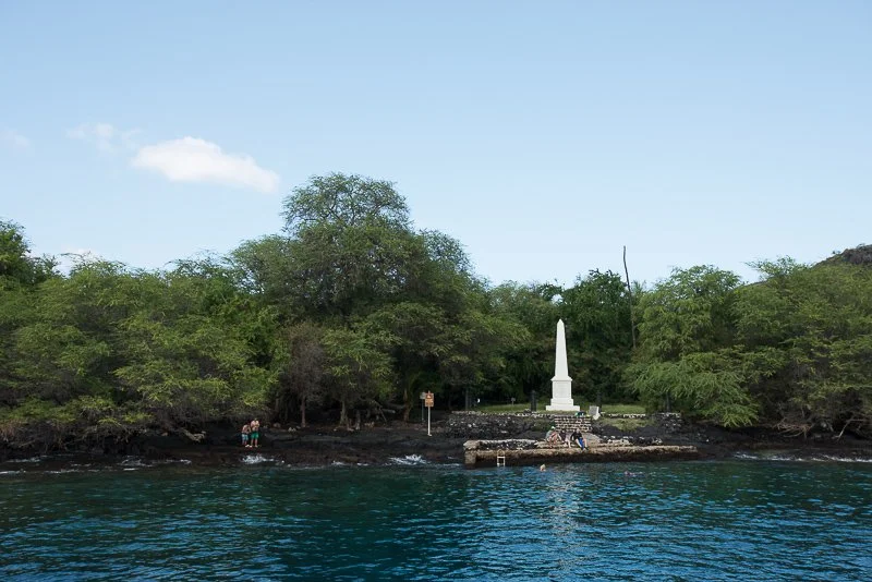
Captain Cook’s Memorial
When most people were in the water we had two masks for me. A normal one and one that would cover your face. I first tried the face one, while my dad was getting a camera ready. That mask did not at all work, the water came in really quickly, it wasn’t the best. I tried the other one that we borrowed and it works out better. We FINALLY went in the water! I stayed near my mom because I was scared, while my dad ditched us to take pictures and videos of fishes.
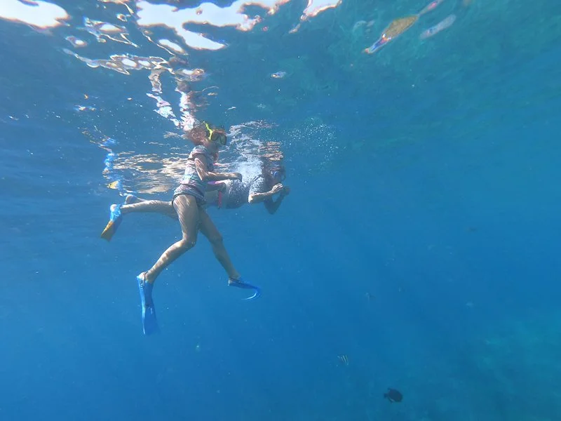
Here I’m snorkeling with my mom
Later I noticed that my dad kept going under the water and bubbles would surface. I asked my mom how to do it and she said something like, “Hold your breath, you’ll be doing it right if bubbles surface.” So when I try it. I, I…. I FAILED. Sniff sniff. Water came pouring in. You can blow air to get the water out but I fail at that, so I take the long process of taking off the mask, dumping the water, and putting the mask back on. I try again and this time with my ninja skills I photobomb my dad. That was fun. I kept doing that.
Me photobombing my dad
More and more I started to let loose from the chains of being afraid. That was a nice feeling. At one point my dad caught me. My streak of sneakiness has ENDED! So sad.
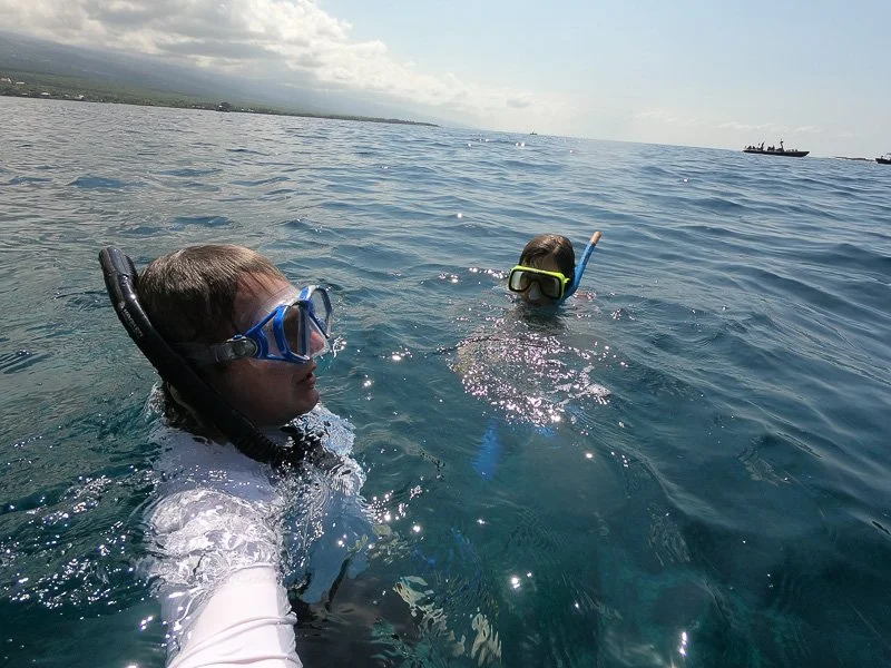
My dad and I
Later I was under the water and my parents were above and some noise occurred. They lead me clueless back to the boat. A woman was helping people get on the boat said to me, “That’s one of our masks.” I took off the mask and gave it to her. We took a seat on the boat and I ask still clueless, “Whats happening?” Don’t remember which parent but one said, “ We’re leaving.” Oh, when did that happen? Mmm Ok! Then lunch was served. There were burgers, hot dogs, coffee, oranges, and some salad. I think. I had seconds again. On the way back I fell asleep against the boat railing. I was worn out, what do you expect?
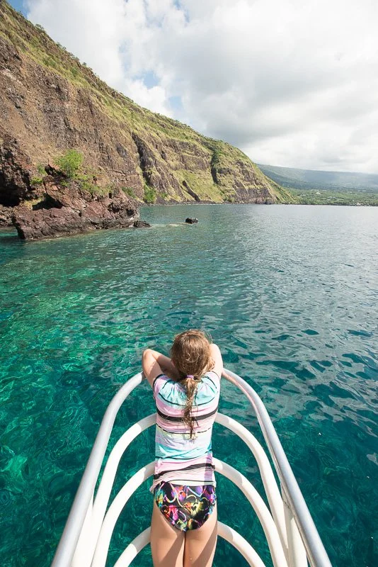
Me falling asleep against the railing of the boat
When I woke up my mom took me in and I fell asleep again.
Later the people outside saw a whale. We kept looking for whales then. After a while we went back to the dock. We headed to the condo where we relaxed for the rest of the day.
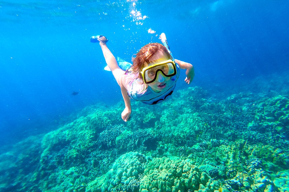
Witnessing my Daughter’s Growing Snorkeling Confidence in Hawaii
Witnessing my Daughter’s Growing Snorkeling Confidence in Hawaii
We had told our 8-year old daughter Kate about the beautiful island, the volcanos, the many different landscapes and the awesome water life. This was our first trip to the Big Island of Hawaii for the three of us together. I’ve visited Hawaii two times before with my wife Marie and this was the first time we brought Kate with us. To get her prepped for going into the ocean, I had taken her a couple of times to our local pool to teach her snorkeling. One time I also brought my brand new GoPro that my wife had bought including a water proof case, specifically for this upcoming trip.
When we arrived the first day in the afternoon, we scouted a nearby beach we wanted to go to the next day, which was Kahalu’u Beach. It is a relatively quiet area as you can stay at the shoreward side of a reef so the water movement isn’t too crazy. Perfect for Kate to get used to snorkeling in the ocean.
The next day, we arrived early - our condo was only about 10 minutes away - so we could park easily. We were already dressed in our bathing suits and headed for the water. There was only a little bit of actual beach sand which was ideal for putting our flippers on. The water felt cold initially, but we shouldn’t complain with a water temperature that was in the upper 80’s (over 30° C) so we got used to it promptly. Kate was hesitant as the water was shallow and it became rocky already very close to the shore. She held hands with either me or my wife the whole time. I had my GoPro with me and took a lot of photos and some videos. There were so many different fishes, with an abundance of yellow tangs.
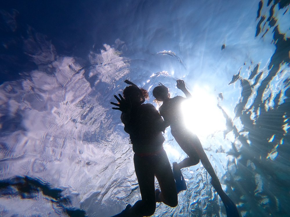
My wife and daughter snorkeling above me
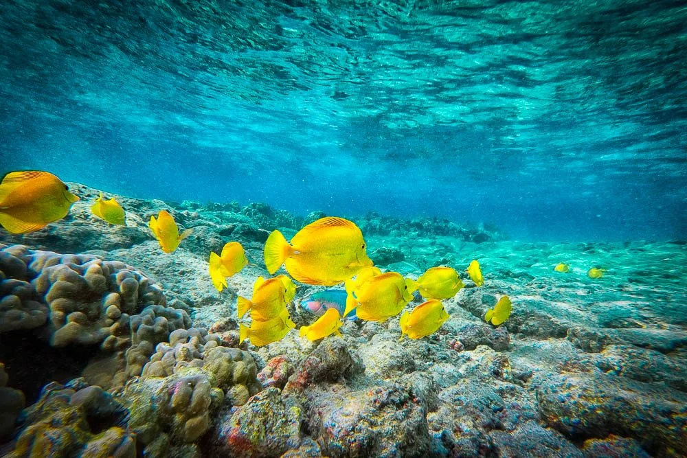
Lots of Yellow Tangs around Hawaii
Kate timidly enjoyed most of the snorkeling and her mask kept filling up with water. I tried to adjust it for her as her hair was caught inside the mask. That only helped a little; the mask just wasn’t the best fit. All in all we spent about an hour.
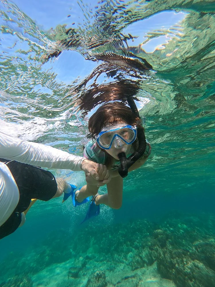
Kate snorkeling with me
The next couple of days we tried out different snorkeling locations (Kate always holding hands with us) and also traveled all around the island, visited Volcanoes National Park, and Hilo on the other side. That’s where I was able to get a lot of photos and videos of green sea turtles (honus).
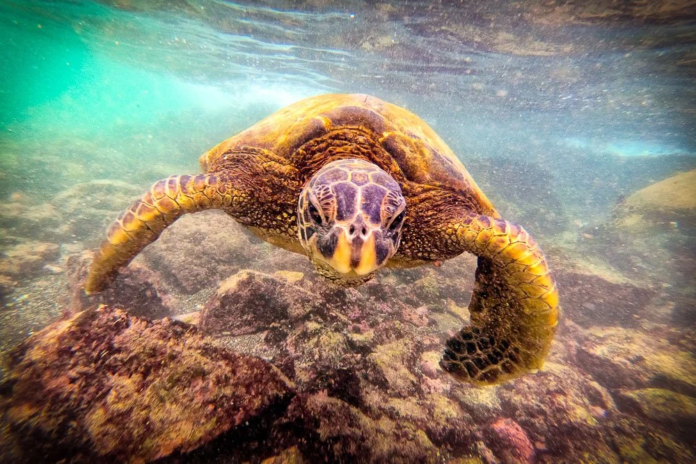
A green sea turtle or honu
I have a tutorial on my YouTube channel in which I color a 12x8” photo of a sketch I did with water soluble graphite pencils of a honu.
In Carlsbad, CA one of my friends had given me a lot of tips of where to go and what to do on the Big Island, ranging from what restaurants to eat at, art galleries to visit, to the best snorkeling spots. She said that one of her all-time favorite snorkeling tours is with Fair Wind snorkel boat cruises and that the morning cruise to Captains Cook's Monument at Kealakekua Bay is awesome. So we made a reservation. The day before our trip we went to a store and rented a full face mask for Kate to see if she’d like that better than a regular mask. If so, we’d buy it, if not, we’d just return it the next day after the cruise.
The day had come. We got up early again - I believe we got up early pretty much each day as you just cannot stay in bed on this beautiful tropical island with so much to see and do. We checked in and received our boarding tickets. As we would board about 30 minutes later, we sat down at some picnic tables and had a simple breakfast. Kate also tried another snorkeling mask, a regular one that covers eyes and nose, as a precaution the full-face mask wouldn’t work for her.
We boarded the large catamaran with about 30 other people and set sail. The views of the island from the boat were spectacular. The Kealakekua Bay was much further south and we spent all our time on the outdoor decks. The boat turned around Keawekãheka and Cook Points and slowed down. The boat stopped above an anchor point and one of the crew members jumped in the water to attach the boat to it. The water was as clear as ever as you could easily see the bottom. You always hear that visibility underwater in Hawaii is 100 feet, and that probably was the case here too.
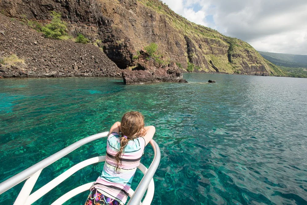
Arriving at the snorkeling spot
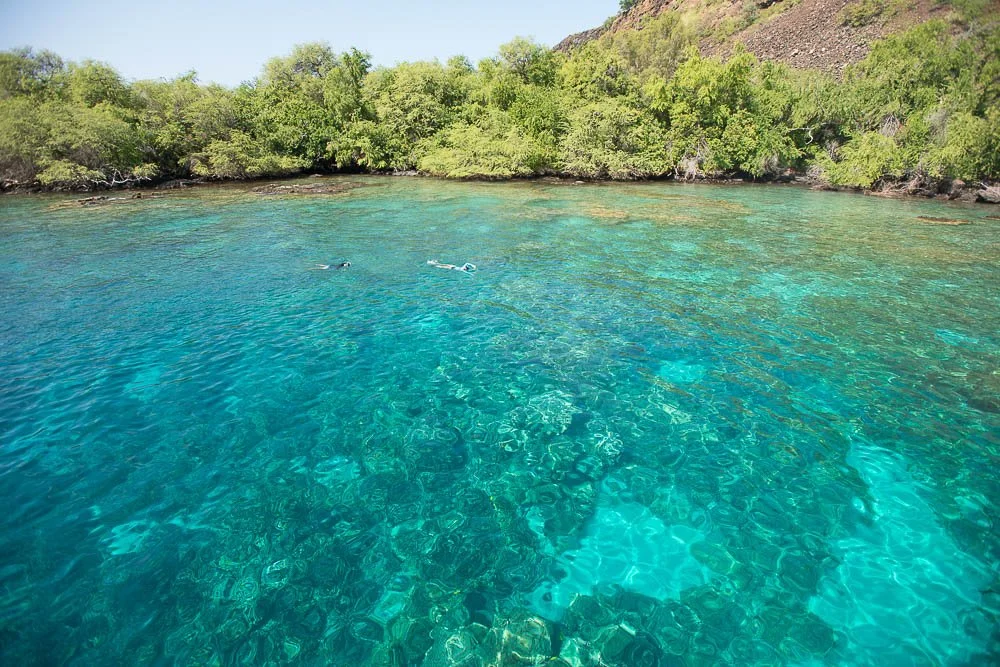
Blue clear waters at Kealakekua Bay
The captain laid out the rules for us. One of those was that you always had to stay in the deeper parts of the water, so you wouldn’t touch - and damage - the sensitive corals. The water could be entered easily at the back of the boat by stairs that went underwater. We put on Kate’s full-face mask and all three of us jumped in. Kate swam around a bit, but she didn’t like the mask as it was too tight on her face. We switched to the one we tried that morning and fortunately that worked well.
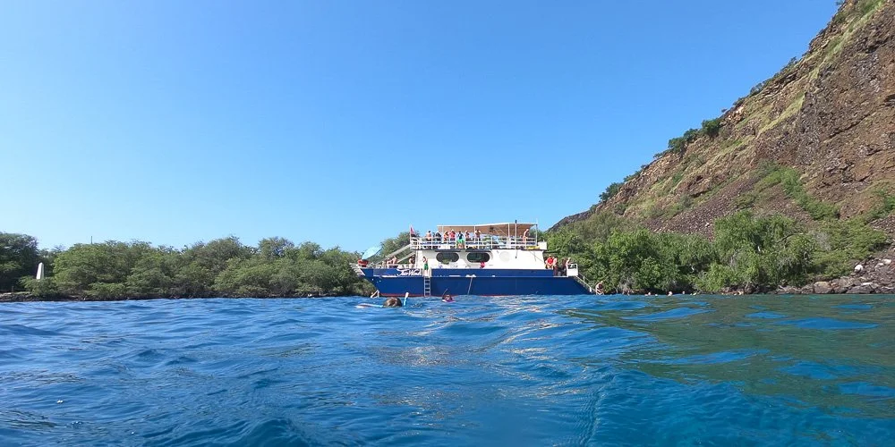
The catamaran in Kealakekua Bay
She held my hand and all three of us swam away from the boat. It was probably about 20 feet deep. The bottom was covered with rugged rocks, corals, urchins and vegetation. And lots of fish everywhere.
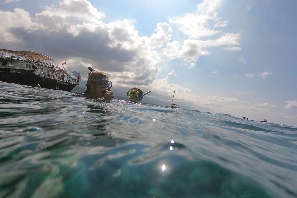
Marie and Kate together
Marie took Kate and they swam together for a while. Suddenly, Kate let go of Marie’s hand. She was on her own. She looked comfortable and was taking great pleasure in her time in the water.
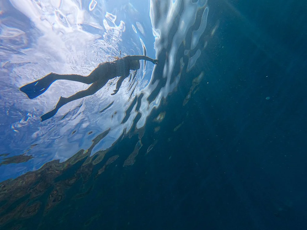
Kate going on her own
At some point, she took a deep breath and dove underwater, enjoying the weightlessness among the fishes in the deep-blue water. As she rose back up to the surface, she blew the water out of the snorkel with a strong puff. She knew she could do this but hadn’t done so yet other than during practice back home at the pool. She appeared in front of me and later told me she was photobombing me.
We spent a lot of hours in the water and had lunch on the boat. I asked Kate how she gained so much confidence suddenly. One reason was a well-working mask, but the main reason she said was the depth of the water. In other locations she was afraid to accidentally touch urchins or any other animal or sharp rock underneath. But here, because the water was so deep, all that was at great distance from her and she felt completely venturous to move around freely.
Marie still says that was the best snorkeling experience ever. In hour house, we have a 3 by 2 foot photo on the wall, of Katie photobombing me.
Kate photobombing me

Roy Kerckhoffs’ California Road Trip in the Summer of 2019 | Day 6
California Road Trip in the Summer of 2019, Day 6
In the summer of 2019 I took my daughter on another road trip from San Francisco to Carlsbad.
Day 6, last day
Just like yesterday morning, I heard the fog horn again while still in my bed, and thought "bummer". But! I opened the door to peek out and saw this:
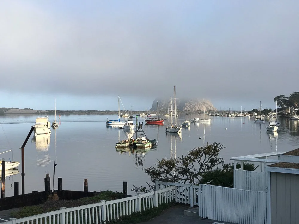
The view from our room
Not a bad view at all! I don't think I have ever seen the fog at the top half of Morro Rock, it's always been the bottom half. So I rushed to get my camera gear out and I ran to the roof of the hotel. Scenes like this can change in an instant.
I set up my tripod and I took several vertical shots again with my 100-400mm lens, so later I could stitch them together into a high-resolution panorama. Fortunately it all worked out. Here is the final result in black and white:
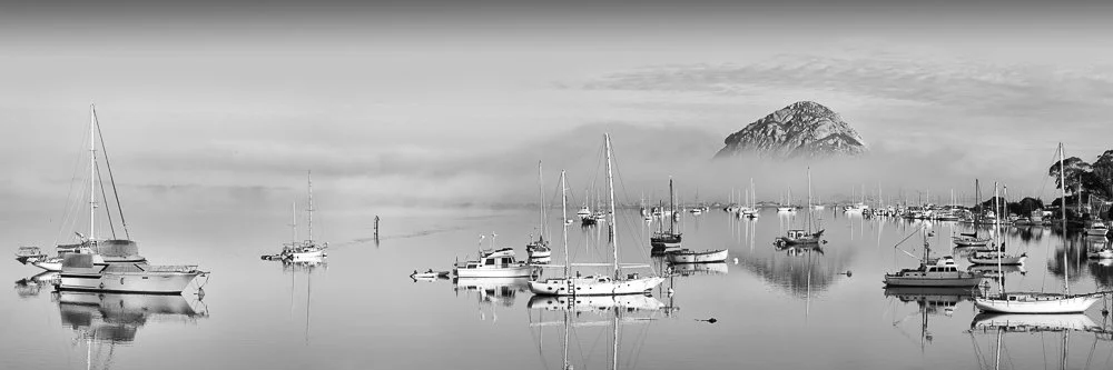
The harbor in Morro Bay with Morro Rock covered in fog
I like creating these large panos because it allows me to print them very big while retaining all the small details.
A couple of weeks later I printed it at 5 feet and colored it with my Marshall Photo Oils:
The hand colored version of “Good Morning Morro Bay!”
After I was done with the photo shoot (the fog was already gone after 20 minutes), Kate and I left. We drove down the coast to have breakfast at the Fat Cats Cafe in San Luis Obispo (I thought Kate would find that amusing and so she did).
Now we just wanted to get home. It was not a too awfully long drive (except where the 101 joins the I-405.... Kate slept through this though).
It was another great trip. Will we go somewhere again this year? An Arizona trip maybe? Hawaii? I don't know yet, but I'm sure I will write about it again.
To read my daughter's account of our time in Morro Bay, click here.

Roy Kerckhoffs’ California Road Trip in the Summer of 2019 | Day 5
California Road Trip in the Summer of 2019, Day 5
In the summer of 2019 I took my daughter on another road trip from San Francisco to Carlsbad.
Day 5
When I woke up I heard the fog horn in the distance and knew Morro Rock was probably going to be covered in fog again. I was hoping for a more clear day so I could see the rock in its completeness but that wasn’t the case. We drove to a small breakfast restaurant at the Embarcadero to have pancakes and waffles.
Katie and I then went for a walk and I snapped some pictures of the rock from one of the piers. After that we headed over to the rock itself. Looking back, you could hardly see the town. The smokestacks of the power plant looked interesting coming through the mist with the sun behind it. We both took our cameras out and walked along the south side of Morro Rock. At the beach we noticed a junior lifeguard camp in full action with kids running around.
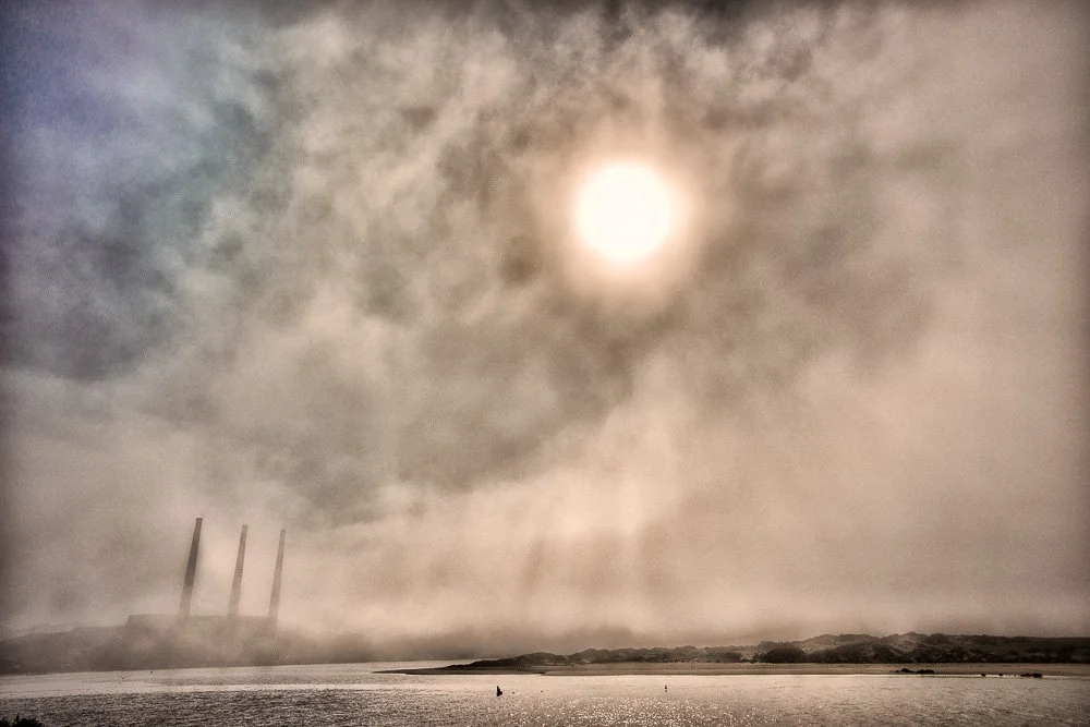
Three chimneys in the fog in Morro Bay
Clouds over Morro Rock
When we walked towards the north side and went across the parking area, we noticed four sea gulls sitting down on the ground. They were quite far apart but were almost lined up perfectly. I explained to Katie that with a long lens this may be an interesting photo when taken low to the ground. She switched lenses like a pro again, putting on her 70-300mm lens and took some shots. They turned out well!
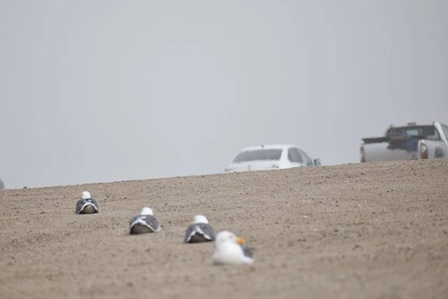
Kate’s picture of the seagulls
When we got to the water on the north side of the rock, of course she noticed dogs and took lots of pictures of them. I took some shots of the lifeguard tower that was there, as the lifeguards just arrived. I was contemplating going into the ocean at some point, but all the surfers were wearing wetsuits and there was nobody in the water without one, so I guess it was too cold.
I told Katie that I had an idea for a particular shot: I wanted to take vertical pictures of the power plant with my long lens, which I would stitch together later. But I needed my tripod for that which was in the trunk of the car. After we got the tripod we walked to the bay side and I couldn’t believe my eyes: there were tons of sea otters in the water close to the shore floating among the kelp. Twenty-nine of them to be exact (Katie counted them). So instead of going for my panorama I started taking lots of pictures of them, and so did Katie. At some point I told Katie that we needed to stop, because we were using up all the memory on our cards and there wouldn’t be anything left for something else. But I kept taking photographs and at some point Katie repeated what I had said about the memory cards. I did my power plant pano and we left.

A raft of sea otters in Morro Bay
Now we were heading for Paso Robles.
We arrived at noon at the City Park and walked around it for a little bit. It was time for lunch and we chose a Thai restaurant on one of the side streets.
While we were waiting for our food, I looked up wineries in the nearby countryside as I was eager to get some wine country shots. So many to choose from, so I picked a winery on Google Maps far away from where we were and asked for directions: that would at least take us on some set route, without having to drive around clueless.
After lunch we started on our route. Quickly the landscape changed and I got excited about my wine country shots. Plenty of vineyards as far as we could see! We stopped at a road that was going up a small hill. We both took some photos of the surrounding landscape with rows of vines extending in all directions and old oak trees scattered among them.
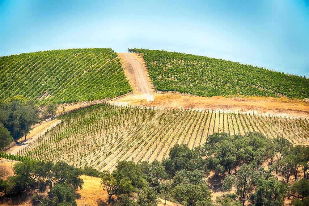
Vinyards in the hills of Paso Robles
A UPS truck showed up and the driver asked us what we were taking pictures off. We explained that we were looking for good wine country shots and I asked him if he perhaps knew other view points. He mentioned Hollyhock Lane, which was a little further down the main road. First I misspelled the name of the road, but while driving I saw the street name sign and took the turn.
I pulled over to the side of the road and we both snapped away. I love how the rows of vines create curvy lines in the landscape around us. Katie took some close-ups of grapes and told me I should do the same. She helped me found some that were sunlit.
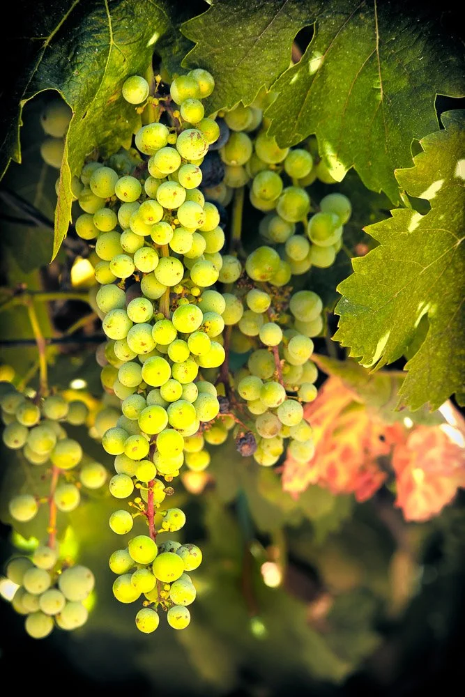
The grapes Kate told me to photograph
We were now driving on unpaved roads and suddenly we saw a bunch of deer and deer babies between some trees and Katie captured them on camera. Next we were driving up a steep hill. It was a little too steep so I parked the car and we walked uphill. A deer jumped up and ran away. At the top you could probably see 50 miles away.
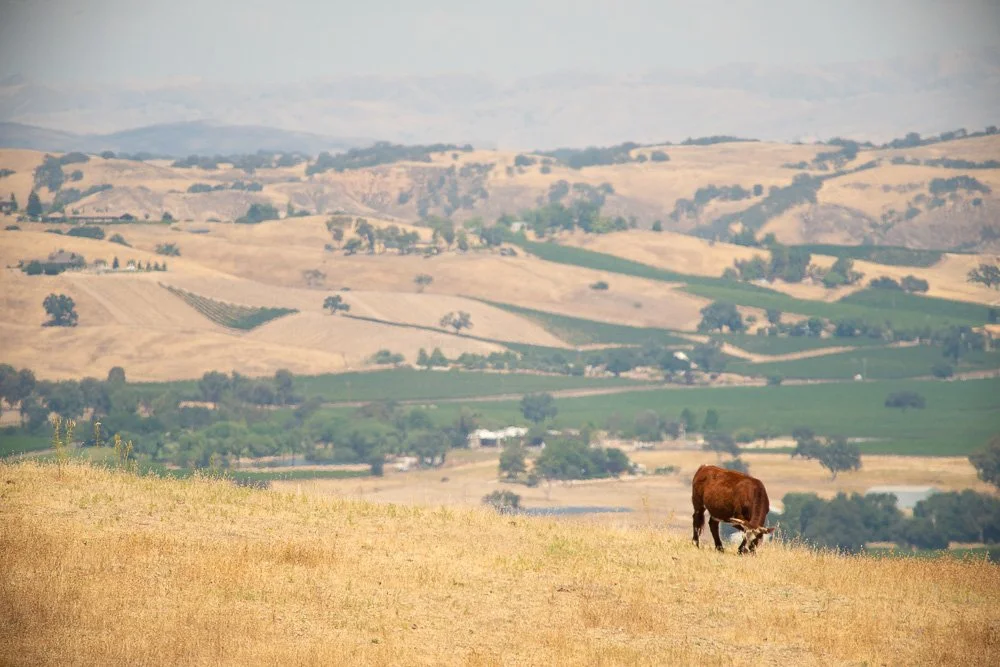
A cow in the hills of Paso Robles
After a short stop at the Mission San Miguel Arcángel (it was closed) we headed back to Morro Bay. At the end of the day we ate at a Mexican restaurant because Katie’s all-time favorite food are tacos.
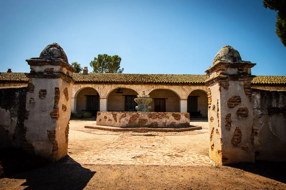
Mission San Miguel Arcángel
Roy Kerckhoffs’ California Road Trip in the Summer of 2019 | Day 4
California Road Trip in the Summer of 2019, Day 4
In the summer of 2019 I took my daughter on another road trip from San Francisco to Carlsbad.
Day 4
I woke up at 5:30am, before my alarm went off (which is pretty typical). I let Katie sleep a bit more while I was getting ready. Closer to 6 I woke her up. Not surprisingly, she was very grouchy, and a little after 6 we were on the road again. This time going north, back to the McWay Waterfall. Unfortunately it was very foggy: it was so bad I couldn’t see more than 200 feet ahead or so.
The waterfall was visible though, and the fog in fact added some interest to it, with the foliage and cliffs to the back of the waterfall disappearing in the mist. Definitely a different look than what you’d normally see with bright blue ocean water and green foliage.
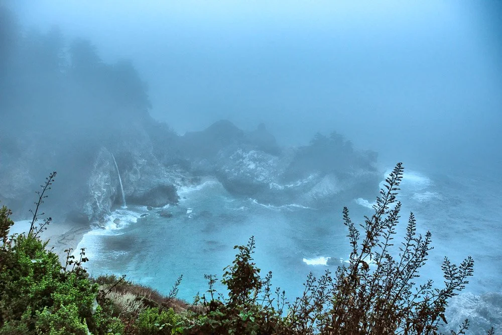
The McWay waterfall and lots of mist
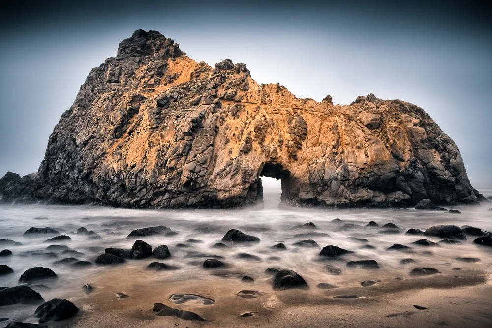
On to Pfeiffer Beach! From the 1 it was a narrow mostly one-lane road with turnouts. But, since we were so early we approached only one other car. We arrived at an empty parking lot. This was one of the most beautiful beaches I’ve seen during our trip: there was a lot of sand, with big rocks sticking out of the water and the large waves were crashing all around them. One of these rocks is the famous Keyhole Arch: a rock with a hole, through which the sun shines in the winter time at sunset. We were of course here at the wrong time for that, but I still obtained a lot of photos of the area, also using my tripod and a 10-stop filter for some long exposures.
The Key Hole Rock at a long exposure
Katie started to become more active and she jumped a couple of times in front of my camera. She also took her own photos. There was still a lot of fog and looking back towards the parking lot, the sun was visible. Because the fog was very non-uniform, light rays were coming down in different spots, lighting up the trees irregularly.
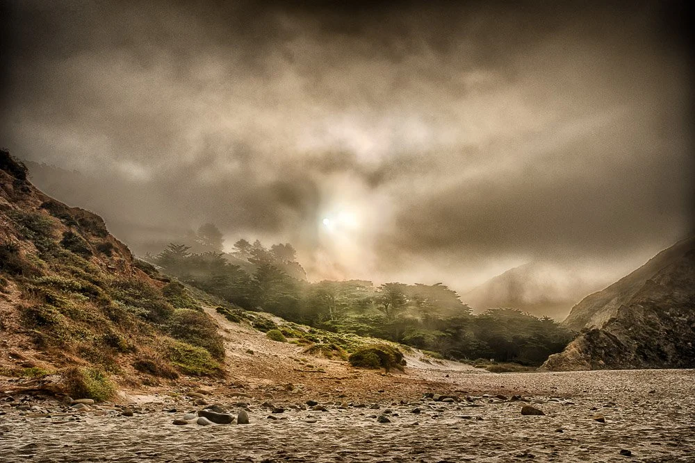
The sun trying to get through fog at Pfeiffer Beach
We headed back to our car and we stopped south of the Big Creek Bridge to get some shots of it. A little later we had breakfast at the hotel. Our next stop was Limekiln State Park, only a couple of miles away, with tall redwoods.
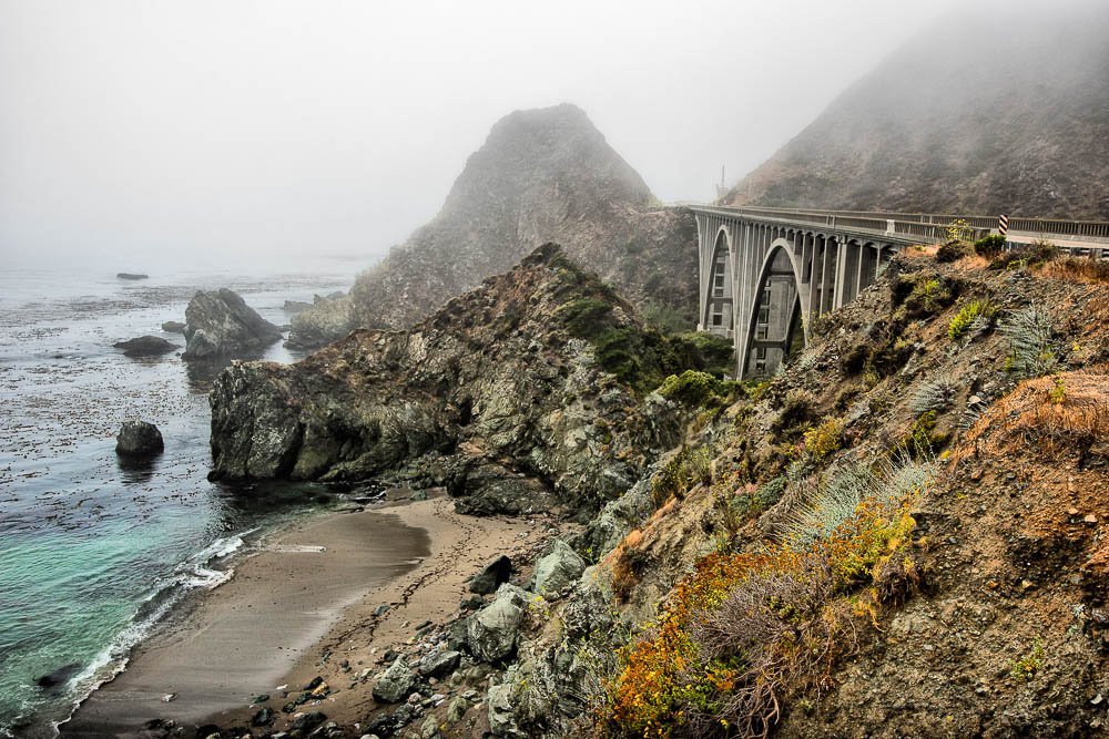
Big Creek Bridge in Big Sur
A beautiful campground exists here where you can choose to be close to the ocean, or in the forest among the tall trees. First we walked to the beach where a creek enters the ocean. I put my backpack with camera gear on a big rock and put my tripod in the sand. I was switching lenses, when Katie yelled suddenly “Watch out, daddy!”. A lot of water hit my shoes and tripod, and fortunately the rock with my camera gear was high enough to stay dry. I chose to put my gear a little further from the waterline.
“Let’s check out these redwoods”, I told Katie. It was a very pretty forest. Several creeks stream down from the mountains here and we crossed a wooden bridge. I pointed out several blue jays and Katie put her 70-300mm on her camera. She seemed mesmerized by the birds and totally forgot about me, wandering further away following the birds. I took some pictures of her taking pictures of the birds. A little later she came back to me, completely disappointed and sad. “Look, daddy, the pictures are all blurry”. I took her camera and set it to auto-ISO, making it a little easier for her. “But now they’re gone”, she said. I told her we would keep on hiking and probably run into more.
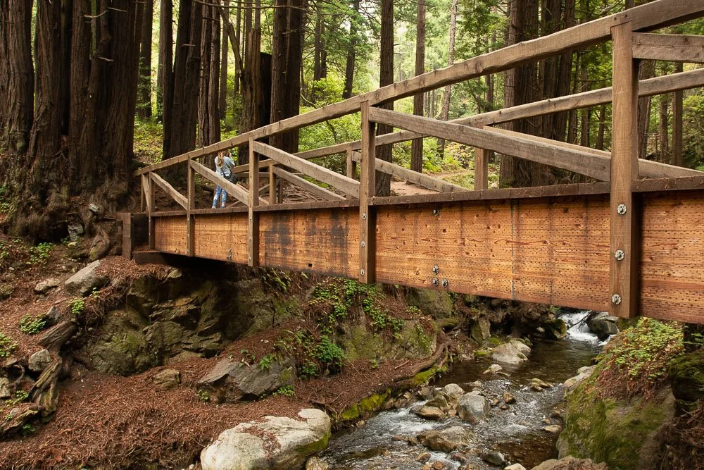
Kate taking pictures of Blue Jays
So we did. She tried again and this time she got some good images of the birds. We crossed another creek several times and after taking some more photos and smelling the evergreens, we headed back to the car.
We stopped at the elephant seal beach near San Simeon. I thought she wouldn’t be that interested since last year she didn’t really want to stop here, but this time she did want to see them and take pictures of them.
Now we were approaching Morro Bay. In the far distance I could see Morro Rock, but the top half was covered in a marine layer, the whole town was covered. I tried to take some shots of it with my 100-400mm lens, taking several vertical images, which I would stitch together later, but it didn’t look very promising.
Because we entered Morro Bay only around 1pm, and check-in at the hotel was at 4, we headed for downtown to grab some lunch at the waterfront, and walked around for a bit. When we exited the restaurant we spotted a sea otter close to us in the bay. “Oh no! It’s my patronus and now I don’t have my camera with me!” Katie said. (Note: a patronus is a guardian spirit animal in Harry Potter). “Let’s just walk back to the car, get your camera, and when we get back here, chances are it will still be here.” I replied. When we arrived back at the scene, the sea otter was still there. Katie was very happy and snapped away.
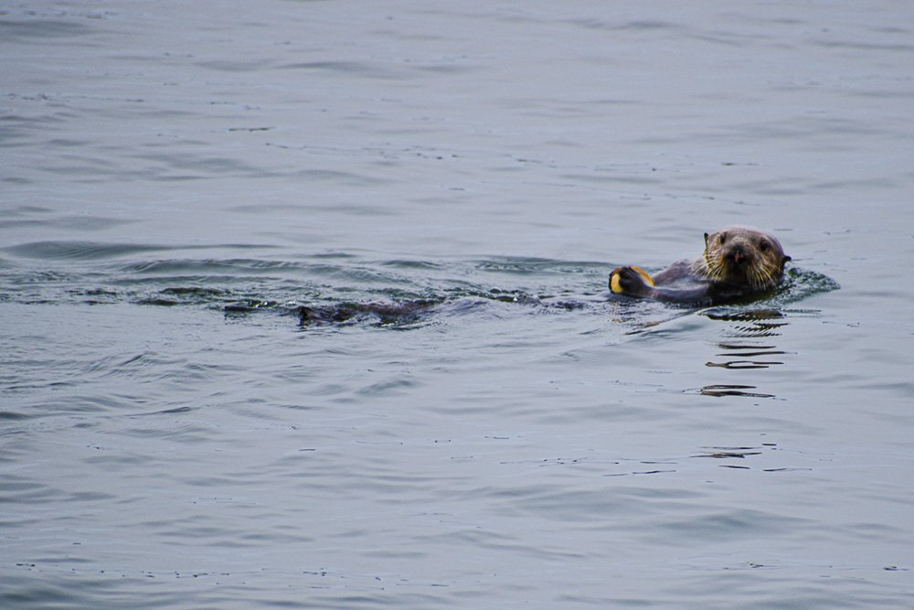
Kate’s photo of a sea otter in Morro Bay
At 3pm we drove to the Inn at Morro Bay: hopefully we could check in early. I had made a reservation on Priceline the day before and had picked a partial bay view. We were lucky that a room was ready, and it turned out to be a full bay view. Our room was on the second floor and there was only a small parking lot between us and the bay. Morro Rock towered in the distance.
After we settled in, we went to the pool, which we had to ourselves. We challenged each other to swim from one side to the other, using for example only one arm and one leg. Just like last year at the pool in Solvang.
Later that evening we had dinner at the hotel restaurant. It was about 7:30pm and the sun was getting closer to the horizon, and with the fog partially lifted, I thought it was going to be a beautiful sunset. But we were still waiting for the check. Finally it arrived, and at 7:45pm we were back at our room. I quickly gathered all my camera gear and went to the roof of our building to take photos of the sunset. It was a beautiful scene, with boats floating in front of me in the bay, in the distance Morro Bay State Park, Morro Rock, and the sun setting to the left of it. Another good ending of a good day.

A nice sunset in Morro Bay, California

Roy Kerckhoffs’ California Road Trip in the Summer of 2019 | Day 3
California Road Trip in the Summer of 2019, Day 3
In the summer of 2019 I took my daughter on another road trip from San Francisco to Carlsbad.
Day 3
This morning we tried out the breakfast camper in The Yard of the hotel. I had a latte and a ham and egg croissant and Katie a hot chocolate and a Belgian waffle. It was good. We headed back to our room to get our things and checked out. We summoned an Uber and headed for Hertz near San Francisco Airport. We were about an hour too early but fortunately a car was available.
Our road trip had started! It would take about 2 hours to get to the start of the 17-mile drive in Monterey. Katie is into Harry Potter now and according to some online test she did, her "patronus" is an otter. I had mentioned to her that a long time ago, before Katie was born, Marie and I had driven the 17-mile drive and I had spotted my first sea otter there. So she was very excited to spot one too and being able to take her own photo of it with her new camera.
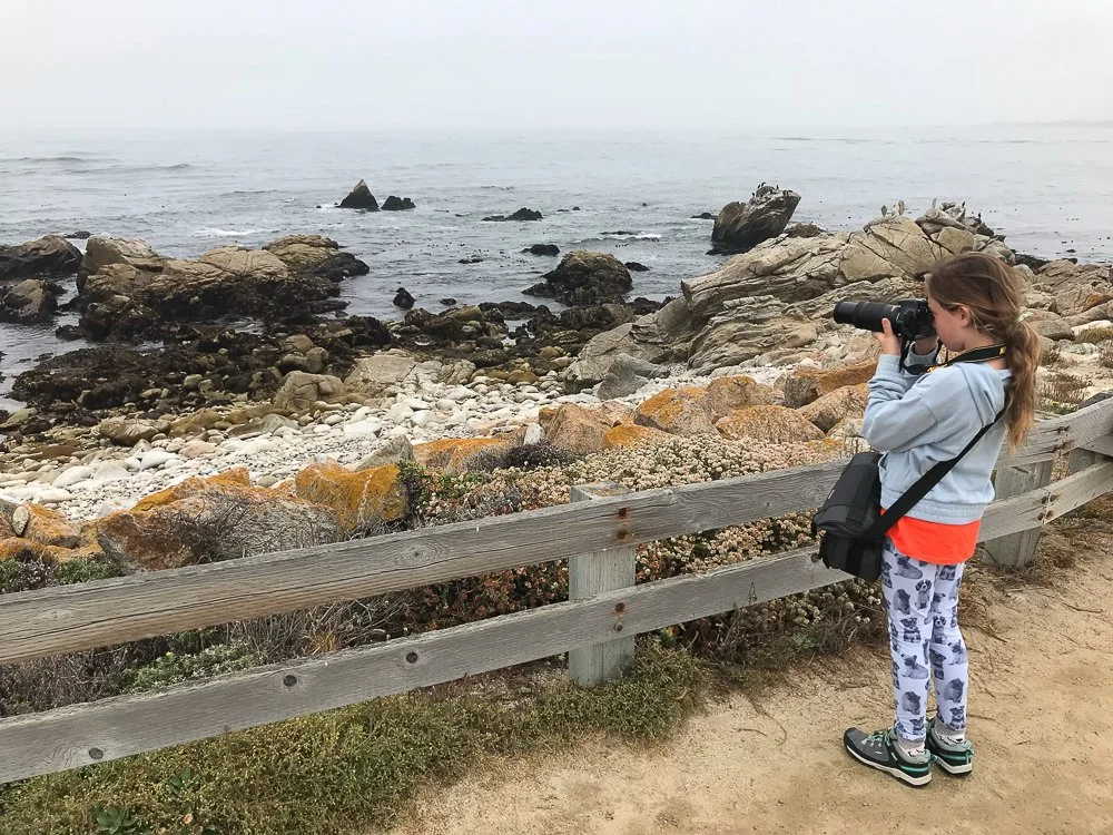
Kate taking pictures of a sea otter
We arrived at Spanish Bay. The beach and the waves looked pretty but no sea otters in sight. So we headed to the next view point. Katie thought she saw one far in the distance but at 300mm it was still hard to see. I tried with my 100-400mm plus a 1.4x converter and it turned out indeed to be one. Still, it was so far out that at this magnification it appeared small in the frame. A little disappointed we continued our drive. Suddenly I spotted a deer on my left. I made a U turn a little up ahead and opened Katie's window. I slowed down and she took her first excellent deer picture! She was very excited and I took a picture of her (and her big smile) holding her camera with the deer on the LCD screen and texted it to Marie. Marie texted back that it was beautifully taken, better than I could ever do. Must have been a lot of auto-corrections in that reply.

Kate showing her first deer photo
We drove to the Lone Cypress. Katie felt a little sad for the tree as it is separated from all other trees. But then again, she said, the other trees are probably jealous because it became very famous.
We ate lunch at the Gallery cafe. Here, I planned for where to stop in Big Sur. I googled it and picked a few spots: Bixby Creek bridge, Pfeiffer Beach, McWay Falls and Limekiln State Park. We would spend the night at Lucia Lodge (I've always wanted to stay in Big Sur with an ocean view). It was going to turn out a little different this day (except for the Lodge, that was reserved).
While I was looking up the viewpoint locations on Google Maps, I noticed a very long red line for CA-1 South near Bixby Creek Bridge. I couldn't believe traffic was so bad, and why?
When we were approaching the bridge, I saw signs like "One Way Lane" and "Flag Person" and "Be Prepared to Stop". And there it was: a mile-long line of cars. It went over the bridge and disappeared in the distance around the corner. No way I could take pictures of the bridge. It turned out, if we had arrived about 30 minutes later, it would have been clear because the road work was just being cleared.
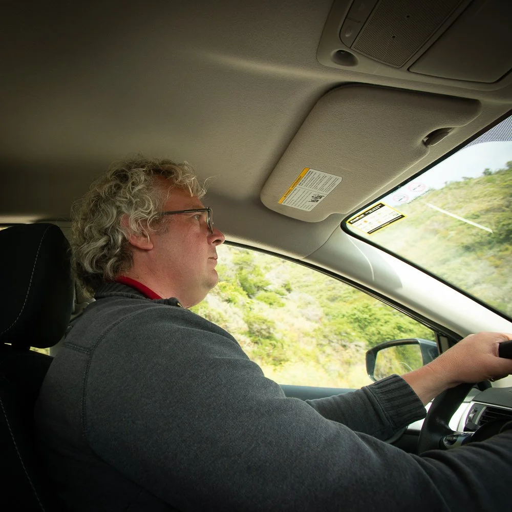
Roy driving the car
So better luck at Pfeiffer Beach? First we missed the turn as cell phone reception was not available and I was not using any drive-by-directions. Katie was keeping an eye out for phone reception and near a gas station there was some. We pulled over and checked Google Maps. It was only a mile back or so. We went back, took the turn, and there were a gazillion cars in front of us. Noooo. We went ahead at 5 miles per hour and after a while we saw a lady turning cars around next to a sign that said "Parking Lot Full". Only residents were allowed in. I asked her when the beach would open the next day which was at sunrise. Maybe McWay Falls then? Nope, everything was full. We must have chosen the busiest week of the year.
I asked Katie to take some photos with my camera through the windshield. I’ve had this idea for a while where I’d photoshop a photo taken at a road into a photo that was taken from the inside of a 1960’s Volkswagen bus. Back in June when I was taking part in the Hermosa Beach Fine Arts Festival, I had the opportunity to take some photos from within a 1960’s VW bus, that was parked close to my booth. Katie took a bunch of photos and one of them was on Big Creek Bridge.
The view of the Big Creek Bridge in Big Sur from a 1960’s VW bus
So now we were heading for Lucia Lodge. The new plan was to get up before sunrise, go back to McWay Falls, Pfeiffer Beach and Limekiln State Park before everybody else.
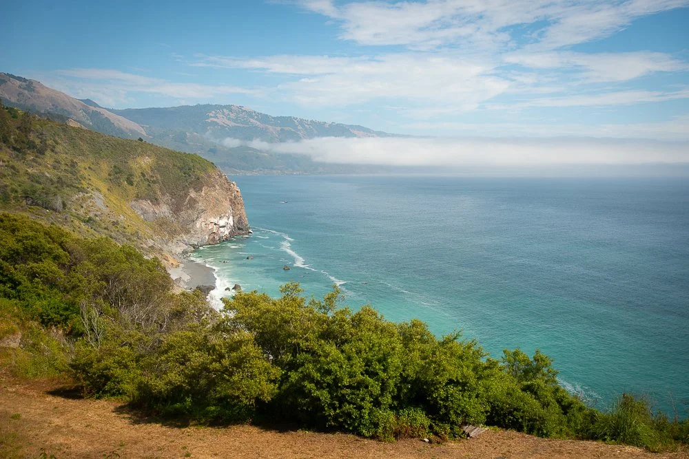
The view from Lucia Lodge
Lucia Lodge turned out to be great. This lodge is where nurse Ratched stayed in the Netflix show “Nurse Ratchet” from 2020. We stayed at cabin 8 with a full ocean view. I left one window open so we could hear the waves all night long. At around 9pm, it was so dark, I tried some long exposures (2 minutes), to see if I could capture the ocean. That worked, but because the fog was already thick, not all the cliffs were visible.
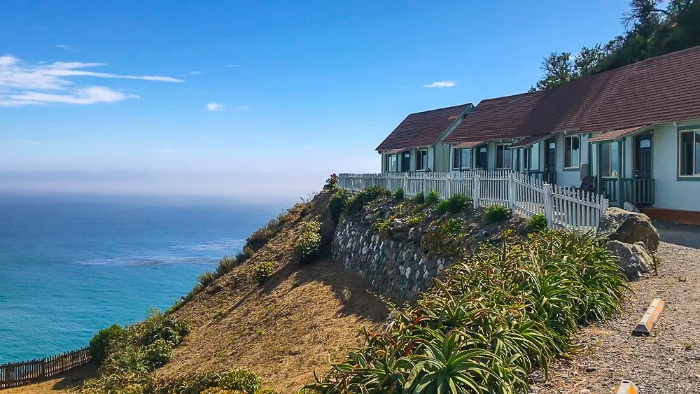
The cabins at Lucia Lodge
I mentioned to Katie that we were getting up at 5:45am. "Noooo, I want to sleep in!", she said. "This is what photographers do, Katie." I replied.
Roy Kerckhoffs’ California Road Trip in the Summer of 2019 | Day 2
California Road Trip in the Summer of 2019, Day 2
In the summer of 2019 I took my daughter on another road trip from San Francisco to Carlsbad.
Day 2
I woke up first and I let Katie sleep in. She woke up around 7:30 and we headed over to IHOP which was next door. After that we walked over to Pier 39 where I had seen a Biscoff coffee shop. Those cookies are the best! We bought some ground coffee, a bag of cookies and crunchy Biscoff sandwich spread. Also the best! I ordered a Biscoff Latte. We walked out and I took my first sip. Well, uh, that was certainly different. At first I thought maybe I'll get used to it, but a very sweet latte with a cookie taste turned out to be something I could not get used to.
It was around 10am now and my plan for the day was as follows: take the cable car from one turnaround to another. From there walk to Chinatown, look around and eat lunch. After that it would be around 12:30 when the Museum of Ice Cream opens. Things turned out a little different.

Kate hanging from the side of the cable car
We did take the cable car and because it was Monday the line was very short. In fact, we could hop on the very next one and were able to hang on the outside, the way you're supposed to ride a cable car. Surviving some precarious moments (as in being an inch away from a parked bus), we arrived near Union Square. From there we walked to the Dragon Gate and I took some photos.
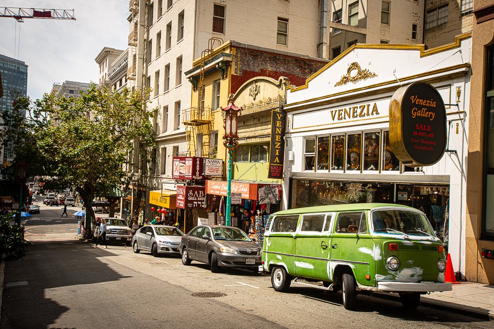
A Volkswagen Bus parked by the curb in Chinatown
We walked up and down Grant Ave and at around noon headed back towards the Museum of Ice Cream. We walked into a sushi restaurant for lunch. Now, neither Katie nor I like sushi, but they have tempura and noodle soups and that works for us. Katie had tempura and I had teriyaki chicken. Now the Ice Cream Museum was waiting for us!
We saw a long line of people which went around the corner of the block. We joined at the end of the line. Then, a lady walked up to us and asked if we were in line for the 12:45am session. I said yes but it started gnawing in my head because that question implied a reservation. So I went online on my phone to buy tickets. 12:45: SOLD OUT. 1:30: SOLD OUT. Etc etc. at 4:30pm there were 9 tickets left so I ordered two. Bummer. I thought of what to do next and I remembered seeing double decker buses driving around town which sounded like a nice and lazy thing to do. I looked up a stop and saw one on Union Square.
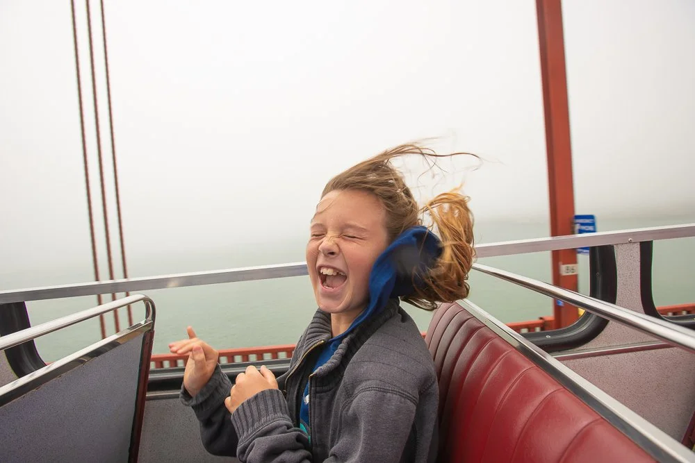
Arriving there we saw a Deluxe Bus and a representative lady from the company walked up to me and started her sales pitch. My natural reaction normally is "No thanks" but since I wanted this it was an easy decision and Katie rode for free. Of course we sat down on the second floor in the section without a roof. The bus tour was going to be between 2 and 2.5 hours so we would be back on time for the Ice Cream Museum. The bus took us through the Dragon Gate (it barely missed the gate but hit some tree branches right after as Katie pointed out), Fisherman's Wharf, and over the Golden Gate.
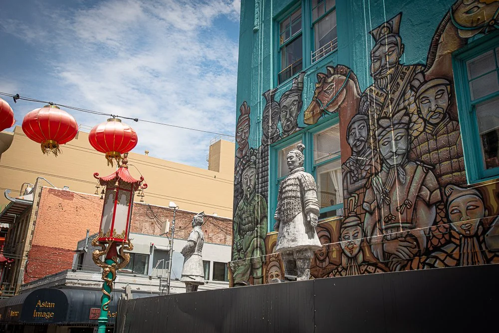
A ride through Chinatown
On the other side I checked my email while the driver was on a 10 minute break. I had received an email from the Museum that said that a car accident had caused a fire hydrant leak and our tickets were canceled. We could reschedule or get a refund. I guess we were not meant to see this museum because the next morning we had a reservation to rent a car from the SF airport.
Kate on the double decker bus, going over the Golden Gate Bridge

Under a pylon of the Golden Gate
Next, we went through a tunnel on the other side with about 2 inches clearance, through Golden Gate Park, Haight and Ashbury (the bus driver: "In the park that is coming up you can see some of the most wonderful hippies on your right"), Jimmy Hendrix house, Painted Ladies, and back to Union Square. I still wanted to see if somehow things got fixed and we headed for the museum. There, I heard a museum dude dressed in pink say that the first floor was flooded. Bummer. Again.

The Jimmy Hendrix house
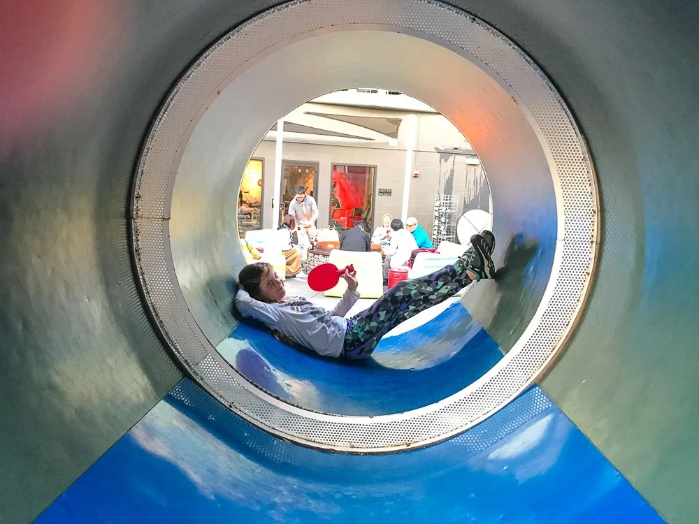
So we decided to walk back to our hotel, which was only about 30 minutes. When we arrived we played tube ping pong and giant four-in-a-row. We both won one round. The hotel was selling s'mores and while Katie roasted one I had a beer sitting next to the fire pit. All in all it was still a good day. I guess we will have to come back next year for another Museum of Ice Cream attempt?
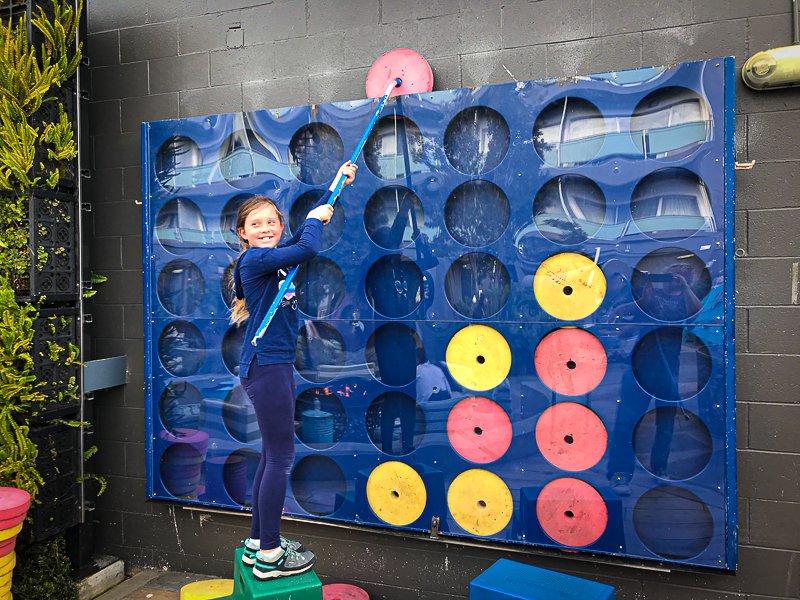
A giant four-in-a-row at the Zephyr Hotel
Roy Kerckhoffs’ California Road Trip in the Summer of 2019 | Day 1
California Road Trip in the Summer of 2019, Day 1
In the summer of 2019 I took my daughter on another road trip from San Francisco to Carlsbad.
Day 1
The plan this year was to fly to San Francisco, stay two nights and drive back along the coast back to Carlsbad. We had to do a partial do-over this year because 1) last year we found out that there is an ice cream museum in SF; 2) we didn't have enough time to explore all of the Exploratorium and 3) the CA-1 was closed in Big Sur so we had to go around it. In addition I wanted to get some more shots around Morro Bay because I have an art show there coming up.
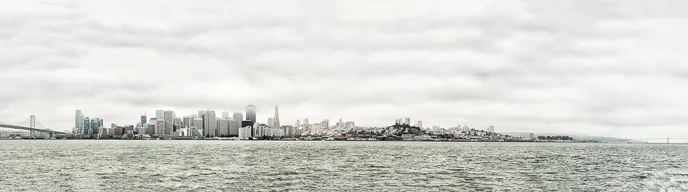
View of San Francisco from Treasure Island from the Bay Bridge to the Golden Gate Bridge
When the flight attendant told us to shut down our electronics Katie asked why that is. I said that electronic devices give off a little bit of an electric field and that it is thought that may interfere with the plane's electronics. I then added that that field is so small it probably doesn't have an effect. She asked "What if all the passengers' devices are on at the same time, would that perhaps cause a field that is strong enough?" "OMG", I thought, "here's my little 10 year old electric engineer" and I told her I was impressed with that line of thought and will have to mention that to mommy.
The flight was pretty short and we arrived at the SF airport a little before schedule. We caught a cab to Hotel Zephyr next to Fisherman's Wharf. What a fun quirky hotel that turned out to be! The walls are made out of ship containers and there are sculptures made from recycled materials all over the place. There is a game room with shuffle board, a pool table, ping pong and more. Outside, in The Yard there are several fire pits (one with a sculpture of old computers and monitors made out of steel), a ping pong "tube", a giant ten-by-ten foot four-in-a-row game on a wall and more. Furthermore, our room had a dart game on the wall with magnets. The ceiling contained a large map that extended from Los Altos to the Muir Woods.

Shuffle board at the Zephyr Hotel in San Francisco
I intended for us to walk to the Powell/Mason Cable Car turnaround on Bay St, take a cable car to Market St and from there walk to the Museum of Ice Cream, which is only a couple of blocks away. However, the line was pretty long at Bay St (at 2:30pm), so we decided to walk to the Exploratorium instead. It again was worth the entrance fees. Katie (and so do I) had a lot of fun pushing buttons, pull ropes, turning wheels, getting mesmerized by illusions, and experiencing the effects of laws of nature. This time, Katie's favorite was the rainmaker and for me it was a glass sphere with two different solutions in it. When you rotated the sphere (and suddenly stopped it or accelerated it), all kinds of patterns (eddies and currents) appeared. It was like a Jupiter simulator.
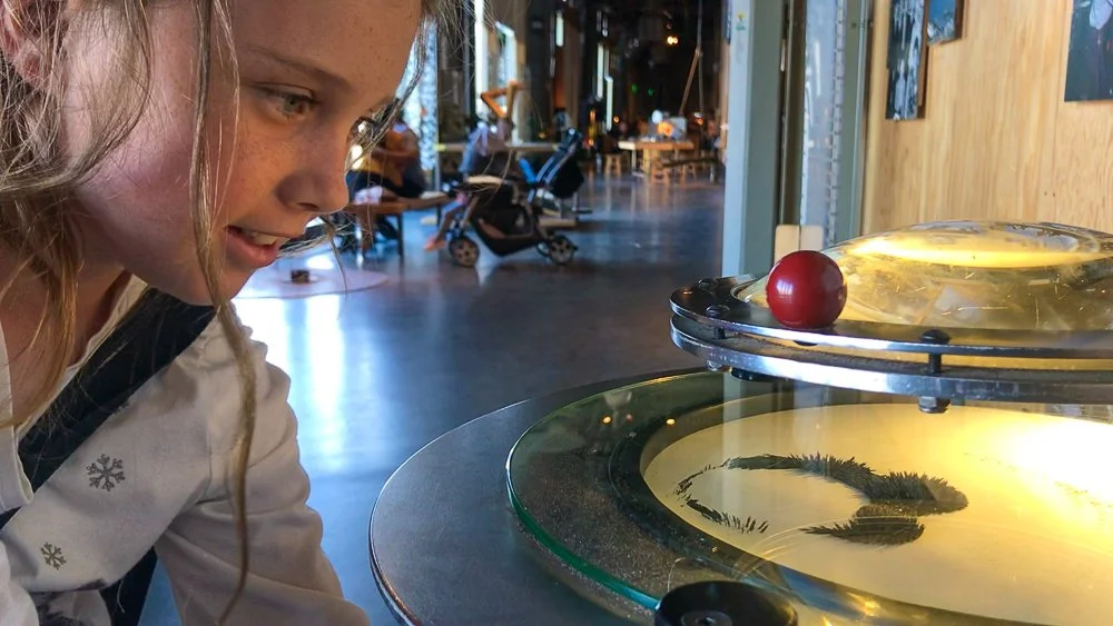
Magnets and iron dust at the Exploratorium
We stayed again till the museum closed and we walked back to our hotel, where we played tube ping pong - this turned out to be Katie's most favorite activity here.
Kate taking a break from tube ping pong
After that we walked to Pier 39, which was so busy that I didn't dare to let go of her hand. Katie was in the mood for soup, and absolutely no hot dogs, burgers or pasta. Well, I was in a pasta mood and noticed Swiss Louis on the second floor. We would check if they had tomato soup. We were sat down at a window with a good sea lions view. Turned out that they didn't have tomato soup but Katie now felt like she was in the mood for a kid's spaghetti.
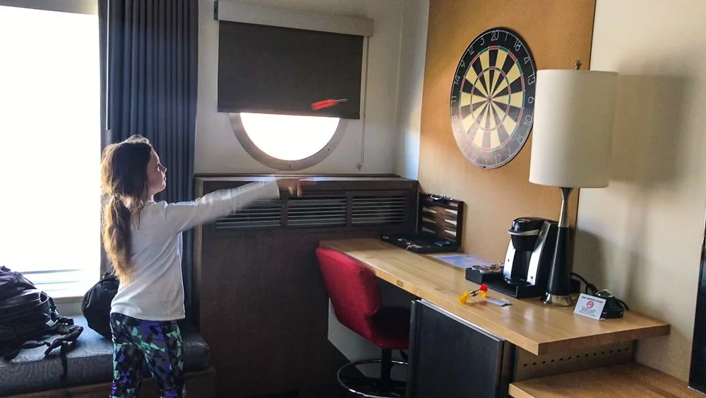
Darts in our room at the Zephyr Hotel
After dinner we went back to the hotel, played some tube ping pong, and went to our room. Katie read a book on the window seating and I watched some tv. It was a good first day and I started planning our second day in San Francisco.
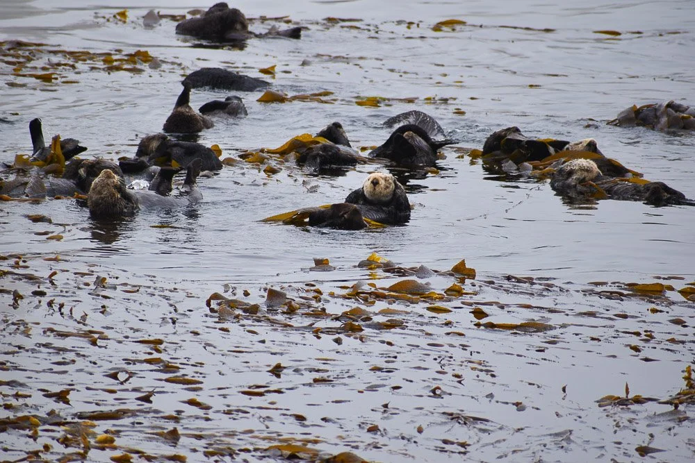
My Daughter’s Description of Our Time in Morro Bay, California
My Daughter’s Description of our Time in Morro Bay, California
In the summer of 2019 I took my daughter on another road trip from San Francisco to Carlsbad. This is my daughter's account from our time in Morro Bay.
“Write down as much as you can remember in an interesting way” says Roy Kerckhoffs while I start this. I remember that we were driving back down to Carlsbad and we stopped to get some lunch. We drove to the nearest place and parked near the docks. We crossed the street and walked to the docks. Someone was looking and pointing at something to someone. My dad and I went to check it out. It was a sea otter! My patronus, you know from Harry Potter? The animal that will protect you from evil creatures? So we saw the otter and I realized that I didn’t have my camera on me. So I tell my dad this and we walk back to the car. It felt like 15 miles away…. So far away. Anyways I got my camera and we went back there. Sadly the otter had ditched us, and swam somewhere else, OR went to get a snack. Then he came back.
A sea otter in Morro Bay
SO CUTE! So I took about… uh… 16 pictures? So after getting over my obsession with the sea otter, we went to have lunch. I’m pretty sure we tried to get tacos but they weren’t open. Then we found like two other places that we could’ve eaten at. But they weren’t open. So after the loooooong search to find a place to eat, we found a place. After eating we went back out to the dock, and the otter was still there. But this time there was also a seagull. ‘MORE PICTURES, WOOO!’ I’m yelling in my head. This time only one.
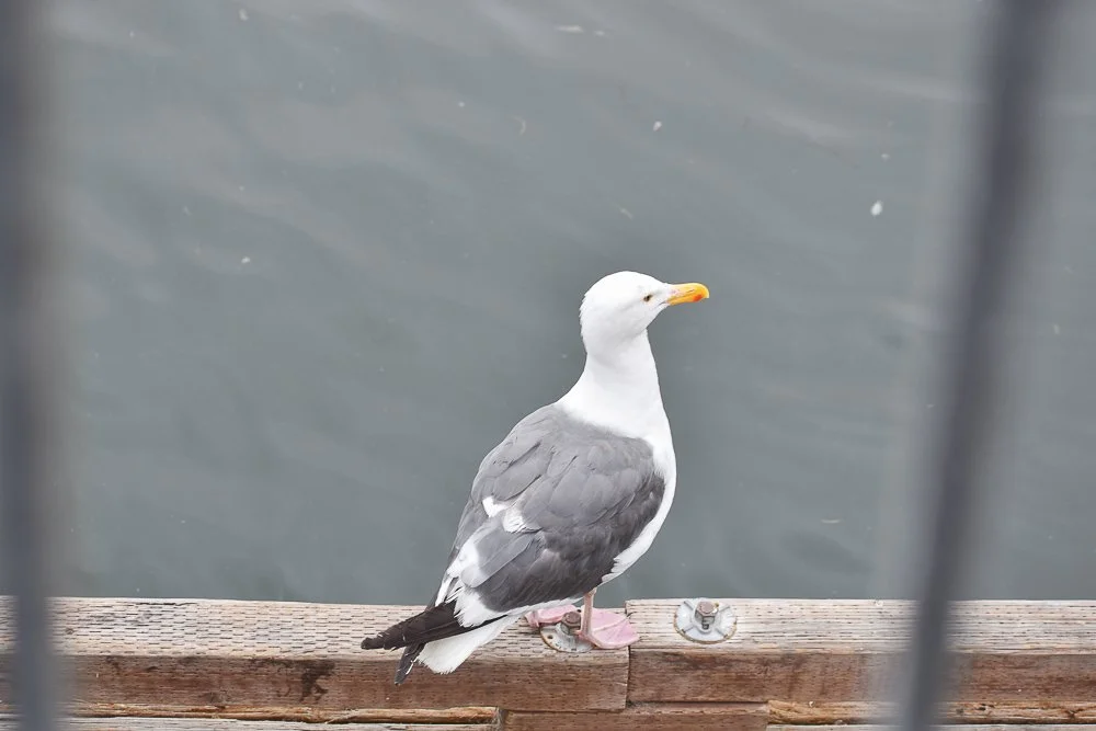
A seagull in Morro Bay
My dad took more. We went on the dock smelling of dead fish. Great thing to smell when you just ate and are full. He took pictures of the dock, Morro Rock from afar, and I believe some boats. Once we started walking to the car, he said to me, “Hey, why don’t we check out Morro Rock?” Or something like that. I just say, “Sure.” So we drive over there, park the car, get out of the car, and see two ways we can walk. TWO! I’ve never went to a rock that’s I dunno 35 times the height of me and is like, “I is a huge rock, here are two ways to walk so you admire my beauty!” So we walk right first which allowed me to get more pictures. Of some bird,
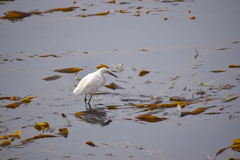
A snowy egret in Morro Bay
A snipe I think it's called:
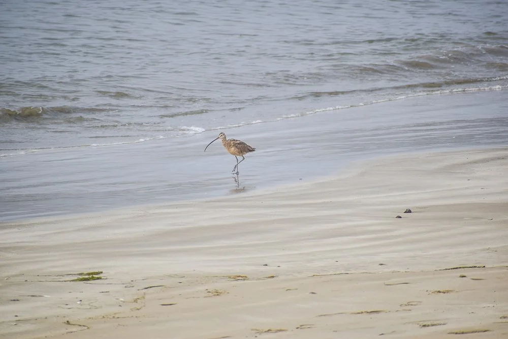
A snipe in Morro Bay
And a dog.
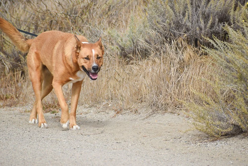
A dog in Morro Bay
Cause why not. Once we’re done exploring the right side, we walked to the left side, and someone comes up to us and tells us that there are anemones over by the rocks. We start heading that way. We see a group of people putting on sunscreen, I look at the back of their shirts and they were the junior life guards! Dun dun daaaa! Anyways we keep walking and find the rocks the people were talking about. I remember I didn’t know how to get through, and my dad with his long legs gets by and ditches me. So I call out something like, “Wait! I needs help!” He helps me and we get through to see the anemones. My mom loves touching them. I don’t know why but that fact creeped us out. My dad touched it and its tentacle things moved around like trying to get a grip on his finger. It was creepy. So we start walking back and we see the junior life guards running around. We walked back towards the car and see a lot of people crowded around one certain area. We look and see a raft of sea otters, with baby sea otters too.
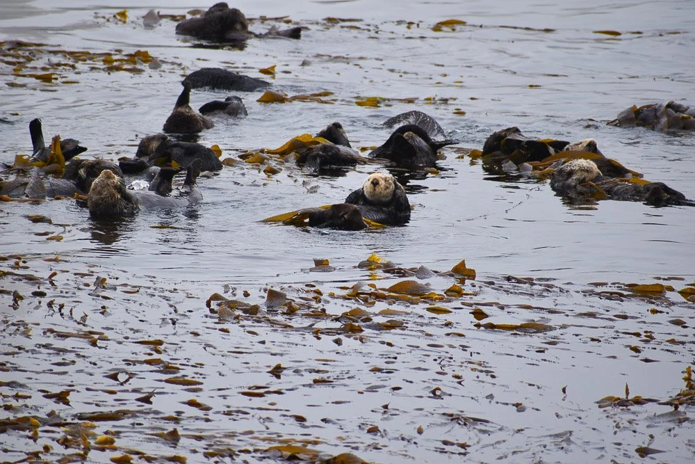
A raft of sea otters in Morro Bay
I remember counting them and there were like 27? I remember saying, “I will never forget this moment.” So I got a bit bored after a while and took some pictures of more dogs, seagulls and squirrels or are they chipmunks?
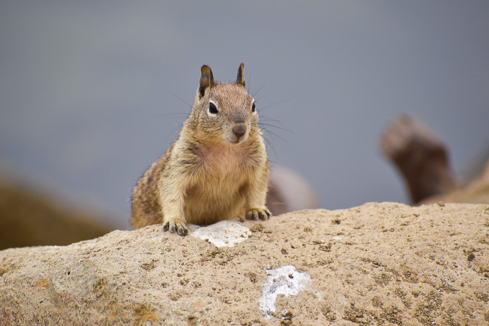
A squirrel in Morro Bay
I remember walking back, and seeing a beach so we go over there and I’m taking photos of dogs. Then we get a call from my mom. We answer and say stuff. Then while my mom and dad are talking, I see this:
Four seagulls in a line
Four birds lined up in a row! I’ve told as much as I can remember, and I hope you enjoyed!

Roy Kerckhoffs’ Arizona Road Trip in 2018 | Day 4
Arizona Road Trip Day 4
In early 2018 I went on a road trip in Arizona, driving from the Grand Canyon to Tucson, with stops at Monument Valley, Sedona, and Jerome
Thursday
Saguaro National Park is divided in a separate East and West part, on either side of Tucson. Not sure which one I should go to I used Google Maps, Google Earth and what people had to say about both on my phone to make a decision. Also, I had my van with me loaded with my art and booth, and did not want to drive over too many rough unpaved roads. Both have Saguaros so that wasn’t the deciding factor. But the eastern part is a bit more mountainous, a little more vast and thought I could possibly get some good scenic shots from that part too. So, the east part then.
The plan was to go there till about 3 pm and then head to Tucson where I was supposed to check in and set up for the Fourth Avenue Street Fair which was taking place that weekend.
I paid the entrance fee and entered the park. These cacti are so cool. From Wikipedia: “The saguaro is a tree-like cactus species in the monotypic genus Carnegiea, which can grow to be over 40 feet (12 m) tall. It is native to the Sonoran Desert in Arizona, the Mexican State of Sonora, and the Whipple Mountains and Imperial County areas of California. The saguaro blossom is the state wildflower of Arizona. Its scientific name is given in honor of Andrew Carnegie. In 1994, Saguaro National Park, near Tucson, Arizona, was designated to help protect this species and its habitat.”
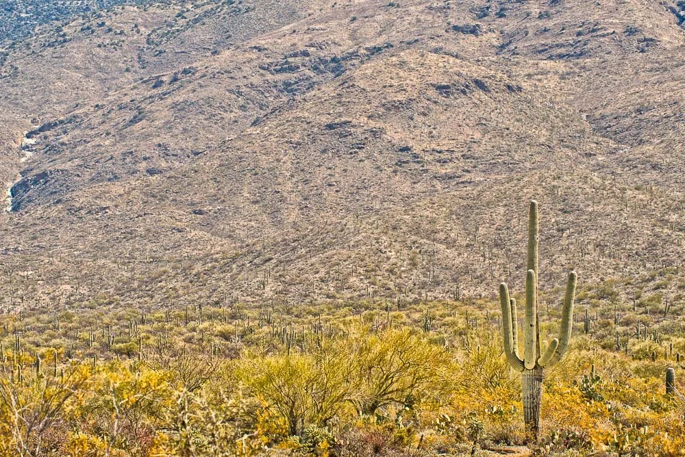
Entering Saguaro National Park
I stopped at almost every pull-out that had an information sign, “educational moment stops” as I like to call ‘em.
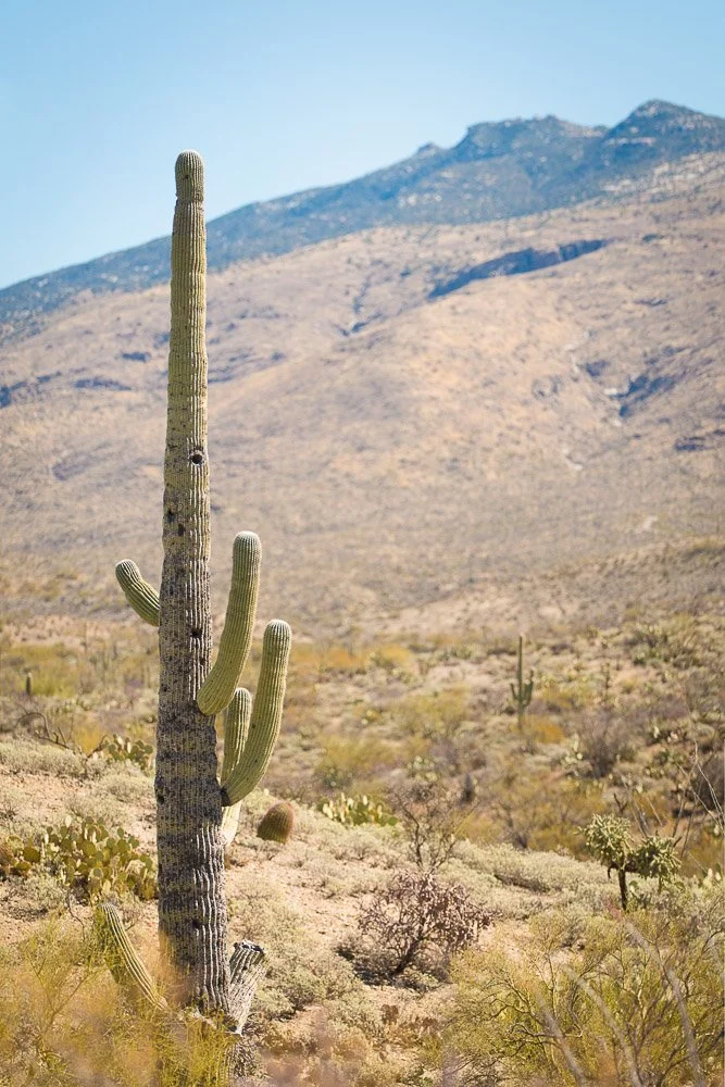
A Saguaro in a less-than-ideal state
There were cacti in all kinds of states, from super healthy tall ones to damaged to completely dead. I thought the skeletons looked quite interesting too and looked very similar to me as the skeletons of cholla cacti I’ve seen before in California, just bigger. I took some shots of a cactus skeleton with a live one in front of it, their shapes very similar, as if it was the same cactus in two different states.
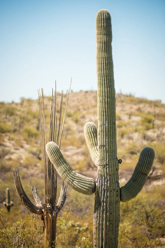
A dead and a live Saguaro Cactus, of similar shape
Moving on, after taking some saguaro close ups I was looking for some more scenic shots and found several perfect spots. One of these I turned black and white not too long ago and colored it with my Marshall Photo Oils and put the process of the hand coloring on YouTube as a time lapse and a tutorial.
One idea I had in mind was to create a “The Arizona Bus” photo, like I’ve done before with my “The California Bus”. In that latter one I put the California flag on the side of an old Volkswagen bus and stuck it on the beach. I had taken some shots of a first generation VW bus in Hawaii only a couple of months earlier. So I wanted to put that bus with the Arizona flag in a typical Arizona landscape. A Saguaro landscape that is. I took a shot of a saguaro with the sun right behind it with its shadow on the road. The bus would be put right in front of that saguaro and the Arizona flag would be perfect with its sun rays beaming out from the VW sign.
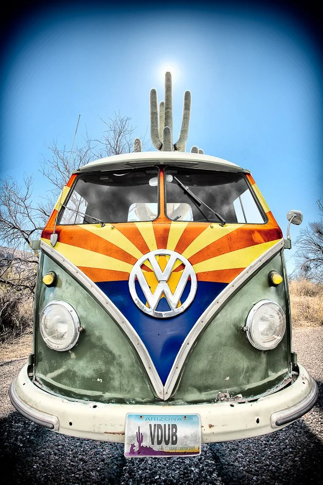
The Arizona Bus
Then I took a photo with my iPhone of me taking a picture of a saguaro. That one I’d stick into the license plate as a little easter egg.

Roy taking a picture of a Saguaro
After completing a loop it was time to head for Tucson and check in for the street fair. I headed to the show’s headquarters and told them my name and that I was checking in. They had some trouble finding my booth numbers and told me to wait for a bit as they figured it out.
After a little while a lady called me and said “You canceled your participation”. I said “I did what?” and then it dawned to me…. remember how I had the flu and wrote on the first day of my Arizona Road Trip that I canceled the Fountain Hills show? Well, it turns out I had put my cancelation into a reply to an email from the Fourth Avenue Street Fair…. Meaning, I also was a no-show at the Fountain Hills show. Fortunately, this show in Tucson had some *real* cancellations and I was still able to set up my booth and take part in the show. And after sending an apology email with an explanation to the Fountain Hills show everything was good.
Roy Kerckhoffs’ Arizona Road Trip in 2018 | Day 3 Part 2
Arizona Road Trip Day 3, part 2
In early 2018 I went on a road trip in Arizona, driving from the Grand Canyon to Tucson, with stops at Monument Valley, Sedona, and Jerome
Day 3, Wednesday Afternoon
There was a mix of rain and snow coming down on my way from Sedona to Jerome. I followed a windy road up the hillside of Cleopatra Hill. Jerome was founded in the late 19th century on this hill, mainly because of the discovery of high deposits of copper ore. At some point in history, the town had over 10,000 inhabitants. Now, the town is a National Historic Landmark.
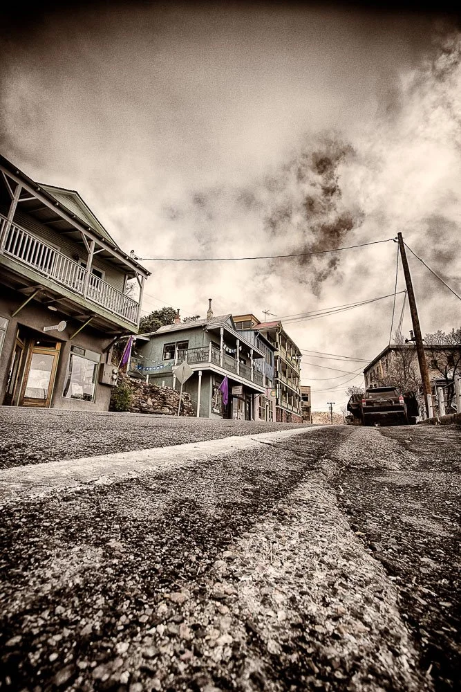
A low perspective street view of Jerome
First I parked my van in a parking lot at the entrance of the town. The skies were full of low clouds. As the town is built on a hillside it exhibits beautiful views from almost any point of the Verde Valley below and the mountain range of Red Rock State Park on the horizon.
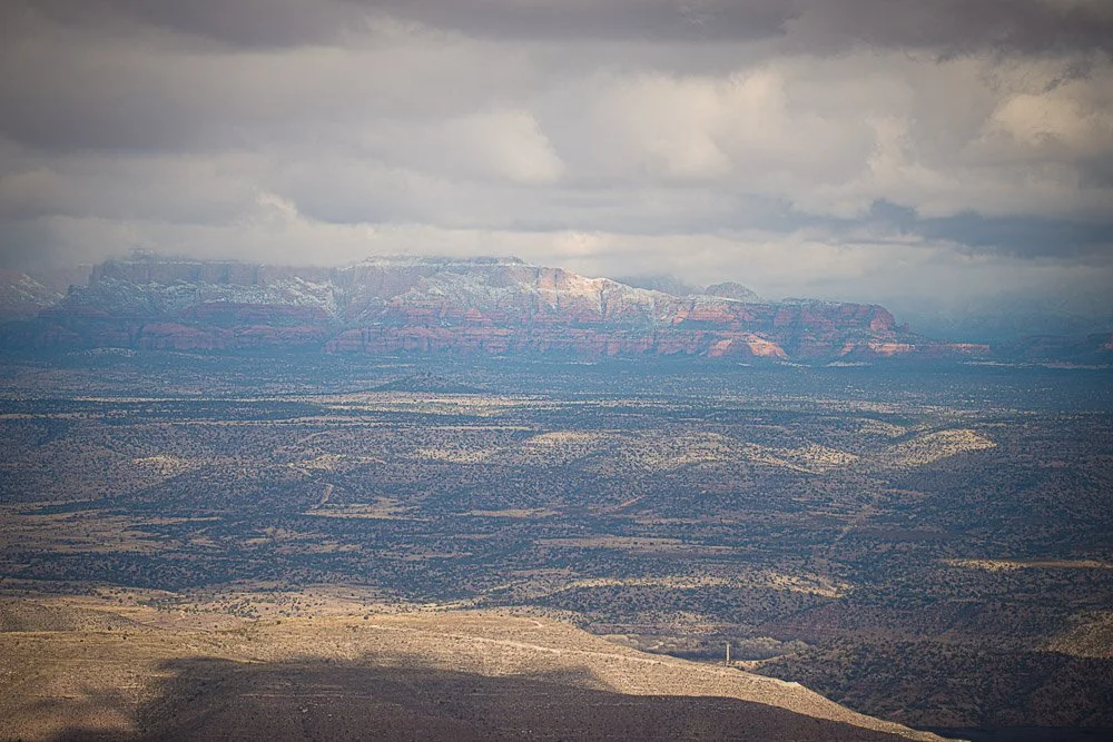
Expansive views from Jerome
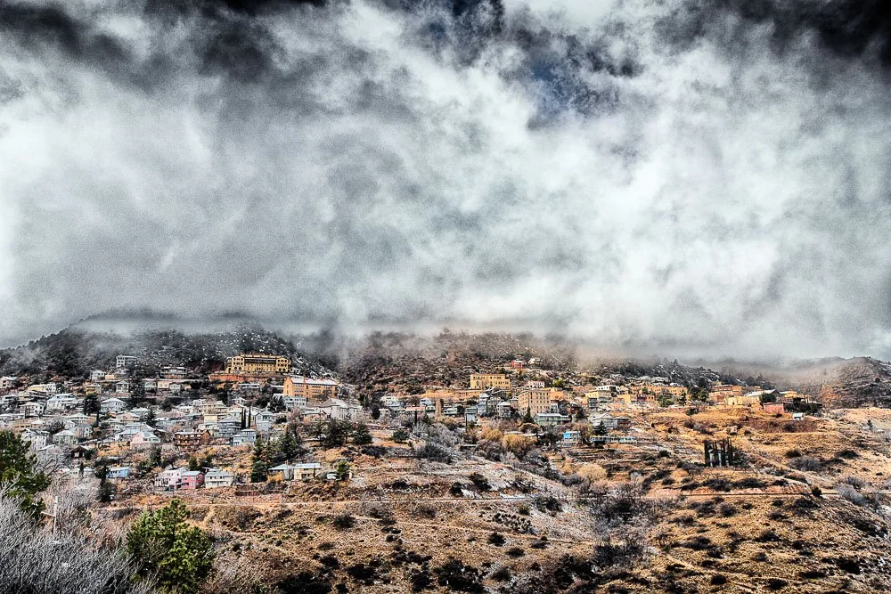
From where I was standing I also had a good view of the town itself and took some shots.
Clouds and fog over Jerome
I hopped back in the van and drove further into town and parked it at the side of the road. Nowadays the population is around 500. When the last mine shut down in the 1950’s, the population was below 100. That’s when the town became known as a ghost town. The many vacation rentals, bed and breakfasts, and galleries are a clue that currently the town is a thriving tourist destination. Jeromes’s Official Visitor Center is a tiny little cabin.
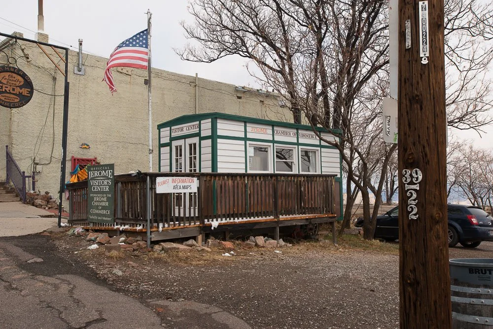
Jerome’s visitor center
After I had lunch I walked around more and took some photos of old buildings which included the Holy Family Church and remnants of the Bartlett hotel (which had some odd toilet exhibition in which people try to throw coins).
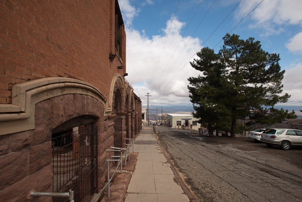
Jerome’s Bartlett Hotel
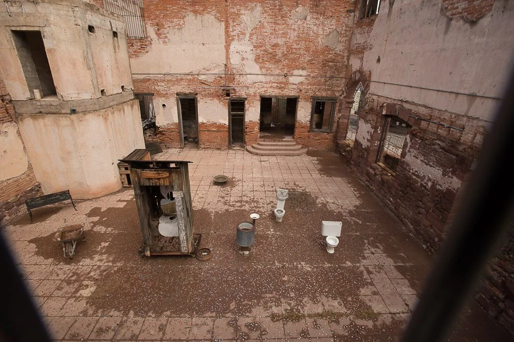
The toilet exhibition at the Bartlett Hotel

The rustic entrance to the Bartlett Hotel
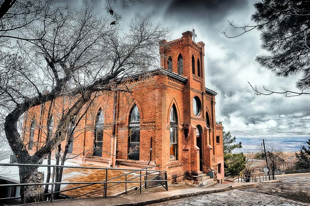
The Holy Family Church
At an art show, I was once told that Jerome is also the host town of a Volkswagen bus gathering, so I may come back here one day and see that too.
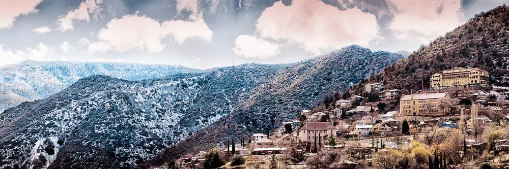
Jerome in the hills
Now it was time for me to head further south. My end goal was Tucson and Saguaro National Park. That was a little too far of a drive at this time of day so I drove to Phoenix first instead - which was about 2 hours - to spend the night. On the way there I already spotted Saguaros everywhere on the side of the freeway when I was approaching Phoenix and was looking forward to tomorrow.
Roy Kerckhoffs’ Arizona Road Trip in 2018 | Day 3 Part 1
Arizona Road Trip 2018 Day 3, part 1
In early 2018 I went on a road trip in Arizona, driving from the Grand Canyon to Tucson, with stops at Monument Valley, Sedona, and Jerome
Day 3, Wednesday Morning
I opened the curtains of my hotel room. Everything was white! It looked very pretty. This - and also the town of Flagstaff - reminded me a little of Mammoth Lakes in California.
After breakfast I walked outside. I love the crispy sound of walking through the snow. Hmmm, but wait, I thought, this is actually a lot of snow, several inches. I looked towards the road and it was not cleared. Now I started to get a little worried. I walked around the building to where I had parked my van last night. It was fully covered in snow, including the windshield, and the parking lot had also not been cleared yet.

My van covered in snow the next morning
I walked up to my van and started wiping the snow off the windshield. This was not easy, as the layer right on the glass was frozen. Then, a hotel employee saw me and handed me a snow broom with ice scraper. That was super helpful and I’d cleared the snow and ice in no-time. I hopped in the van, switched the ignition key and the van turned on without any problems. I cranked up the heat.
My plan was to go Sedona from here, in particular to see Cathedral Rock. Google Maps was telling me to take the AZ-89A. Having a closer look at that I noticed some hairpin turns which was telling me it was some scary mountain road. Scary under current weather conditions that is. I was wondering if I should skip Sedona as I was pretty sure that was not the safest way to get there. So I decided to take the I-17 South towards Phoenix. I thought that the freeway would be all nice and clear. At some point it would be possible to exit the freeway and still head north towards Sedona (the 179 didn’t look that scary). If that area looked fine to me, I’d still try to get to Sedona, otherwise keep on going to Phoenix.
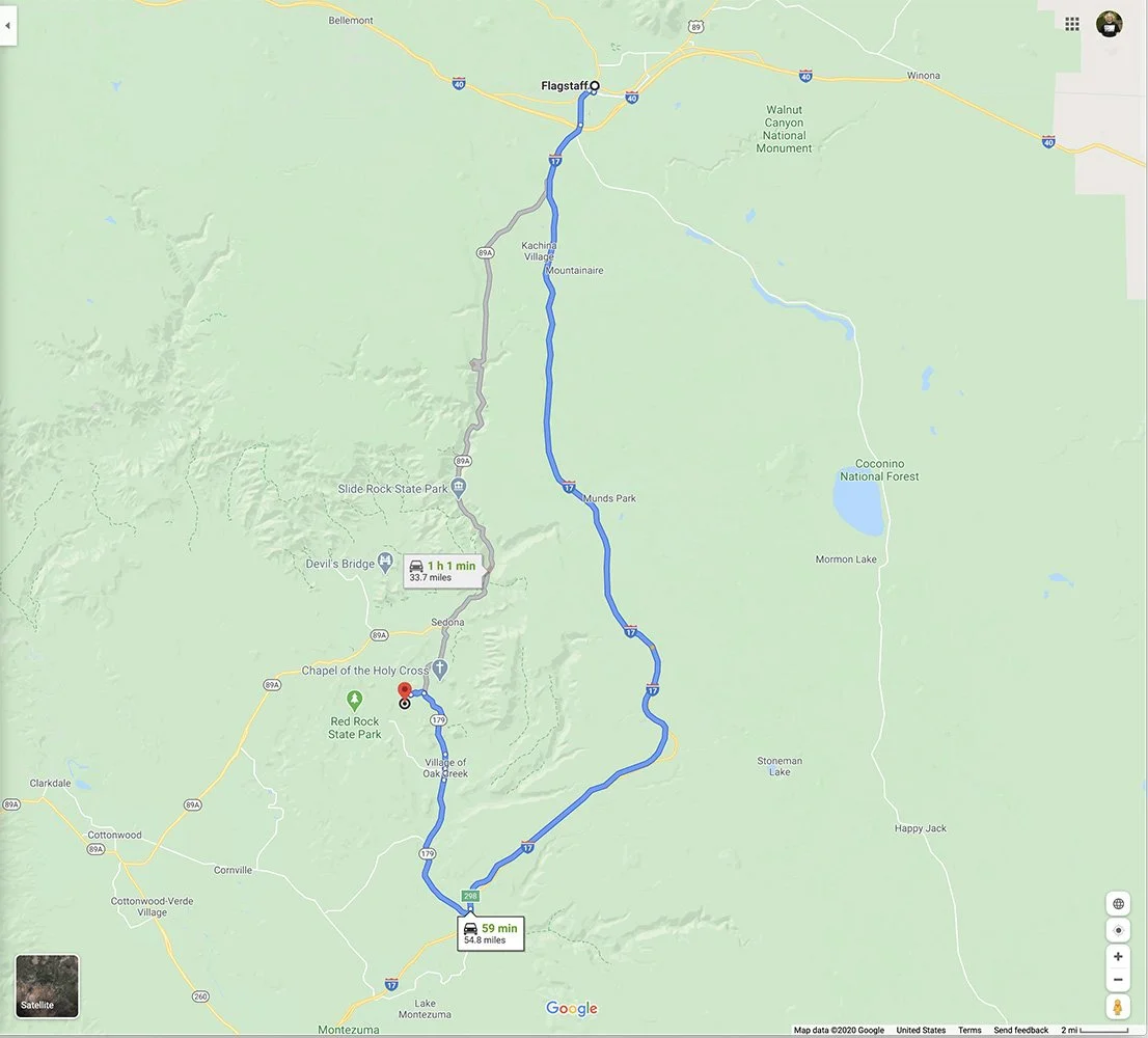
My alternative route to Sedona to avoid tons of snow on the highway 89A
I slowly pushed down the gas pedal. So far so good. I exited the hotel parking lot and followed Google Maps’ directions. Fortunately it was quite early (before 7am) and not very busy on the road yet. Or perhaps people stayed home till the roads were cleared? I inched my way around, going under 5 mph. When a traffic light turned green, my wheels spun for a bit, but then picked up speed. I entered the I-17 and guess what? It looked like the rest of the town and cars were going 10 miles per hour. I joined them.
Having driven for several miles, the snow was getting thinner and at some point it was even all gone. I was driving at a normal freeway speed again. The exit for AZ-179 was still ahead of of me, so I felt more confident I would be able to make it to Sedona.
It was only slightly foggy now, but with all the snow gone, I exited the freeway and was now heading north again towards Sedona. If things would get too bad (the road was gaining elevation) I could always turn around. When I entered the town of Sedona, there was snow on the sides, but the roads were cleared. I found my way to the Cathedral Rock Trailhead.
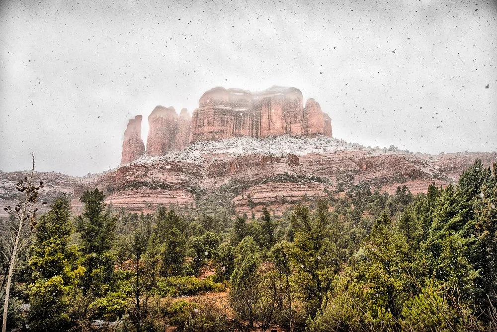
It started snowing again. I took out my photo gear and started walking. Overall, Cathedral Rock looked like the buttes I saw yesterday in Monument Valley (Cathedral Rock is a sandstone butte), but covered in snow it had a completely different feel.
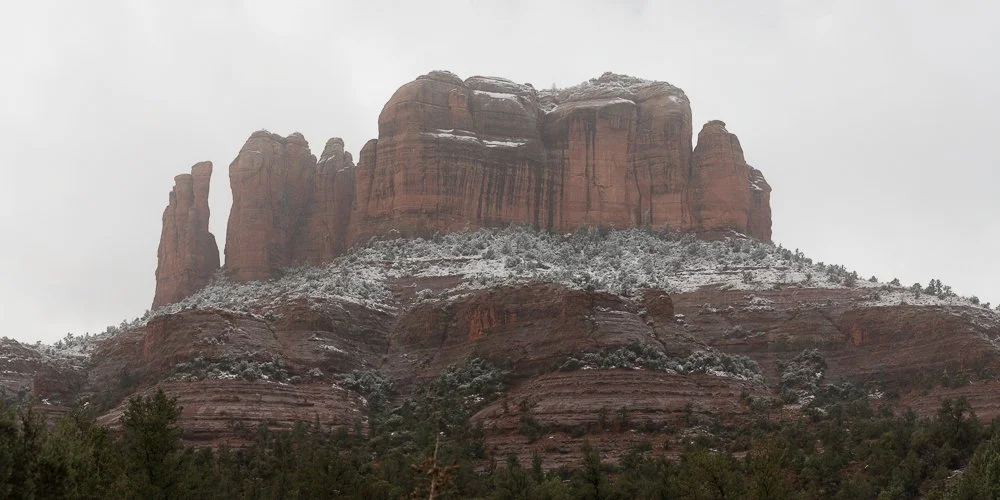
Cathedral Rock in Sedona, Arizona covered in snow
I took several shots of it, using different lenses from a variety of locations along the trail. I also tried to get some shots with falling snow flakes showing in the photos.
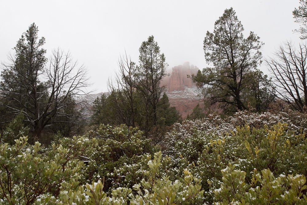
A different view of Cathedral Rock…
It always tough to photograph something that has been photographed many times before (Cathedral Rock apparently is one of the most photographed sites in Arizona), but hey, at least I captured it with snow and snow flakes. Also, by hand coloring I can give it my own twist.
A snow-covered Cathedral Rock and snow flakes
It was late morning now and I looked at Google Maps again where I could go next. Because it was still early, I didn’t feel like going to Phoenix yet (where I’d only spend the night on my way to Tucson). And then I spotted it: Jerome! At art shows, several people had asked me if I had any photographs from Jerome, Arizona, a ghost-town-but-not-really-a-ghost-town. And it was less than an hour away. So I hopped in my van again and started driving. I pulled over one more time, to get a shot of Cathedral Rock from a distance.
Jerome, here I come!
Roy Kerckhoffs’ Arizona Road Trip in 2018 | Day 2
Arizona Road Trip 2018 Day 1
In early 2018 I went on a road trip in Arizona, driving from the Grand Canyon to Tucson, with stops at Monument Valley, Sedona, and Jerome
Day 2
When I woke up in my hotel in Grand Canyon Village I already felt a lot better, recuperating from the flu a week earlier. Today I wanted to drive to the east, to the Desert View Watchtower and from there exit the park on the east side. But my plan after that wasn’t clear yet. I had never seen the iconic buttes at Monument Valley and I knew they weren’t that far. Google Maps said about 3 hours. Or, I could go south to Flagstaff. Or both? I decided to first go to the Watchtower, stop at locations along the Canyon and see how much time I’d have left after that. After all, it was only 7 in the morning now.
I had breakfast somewhere in Grand Canyon Village and started driving east along the Canyon. I stopped at several location to get some panoramic shots of this magnificent canyon. I like to take lots of vertical images, in manual mode, and stitch them all together later. Sometimes I take more than one row too.
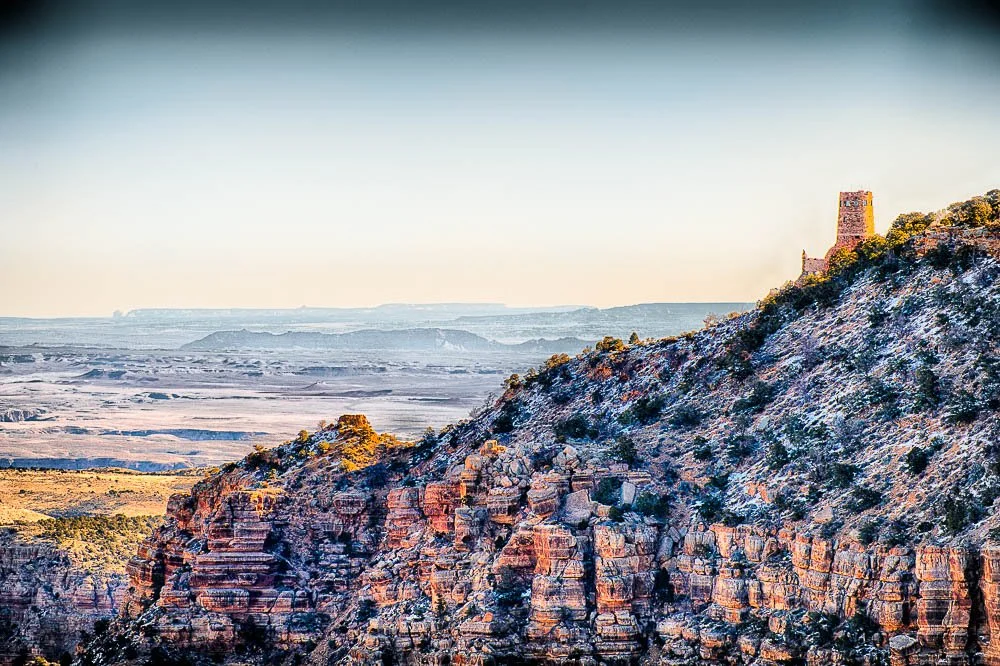
The watch tower at the Grand Canyon from a distance
I arrived at the Desert View Watchtower. This is a 70-foot-high stone building located on the South Rim of the Grand Canyon within Grand Canyon National Park in Arizona, United States. The four story building was completed in 1932. It was designed by architect Mary Colter and built by Fred Harvey and the Santa Fe Railroad Company. It was designed to resemble ancient local watchtowers, which served for protection and storage of food. This tower serves as a rest top and as an aid for the visitor to better understand the past and present life of southwestern native Americans.
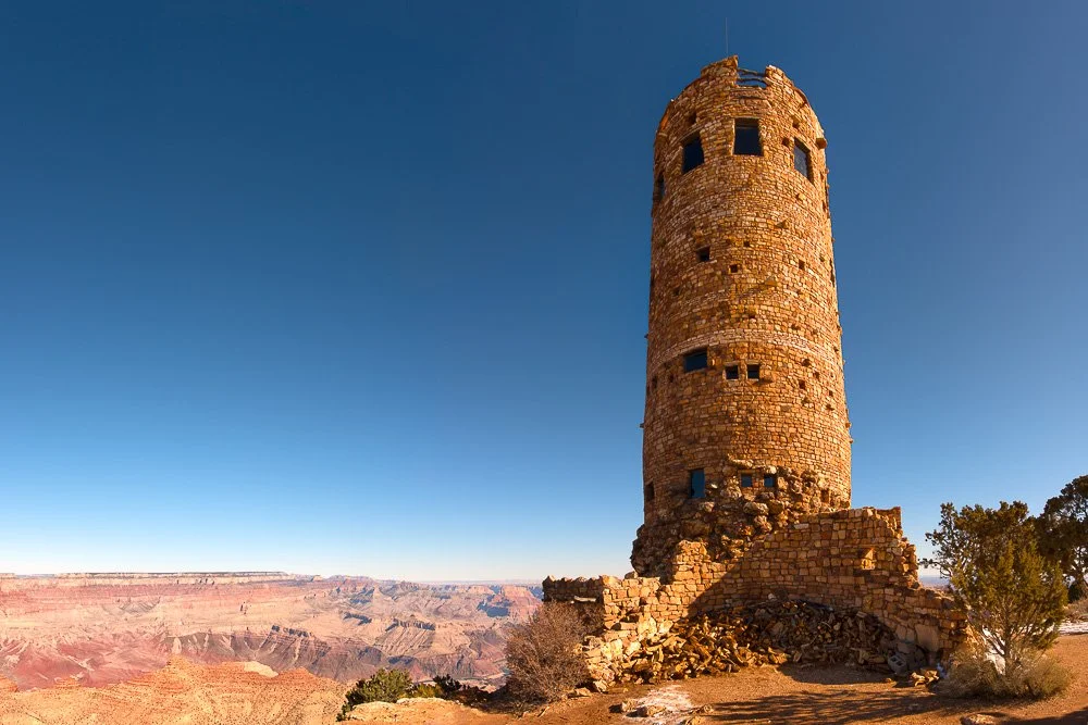
Getting closer and about to enter the watch tower.
Visitors can climb the four stories of the tower and so did I. Numerous wall paintings of gods line the walls of the first floor. The center of the room is occupied by a snake altar, a sand painting, religious crooks and wands, carved wood figures, snake whips and a tray of sacred corn meal. The walls on the second and third floor depict replicas of petroglyphs and pictographs from the Painted Desert and other regions. The fourth floor is at a height of 7522 feet, the highest point along the South Rim. I took several photos from the tiny windows in the walls, that have magnificent views from all around.
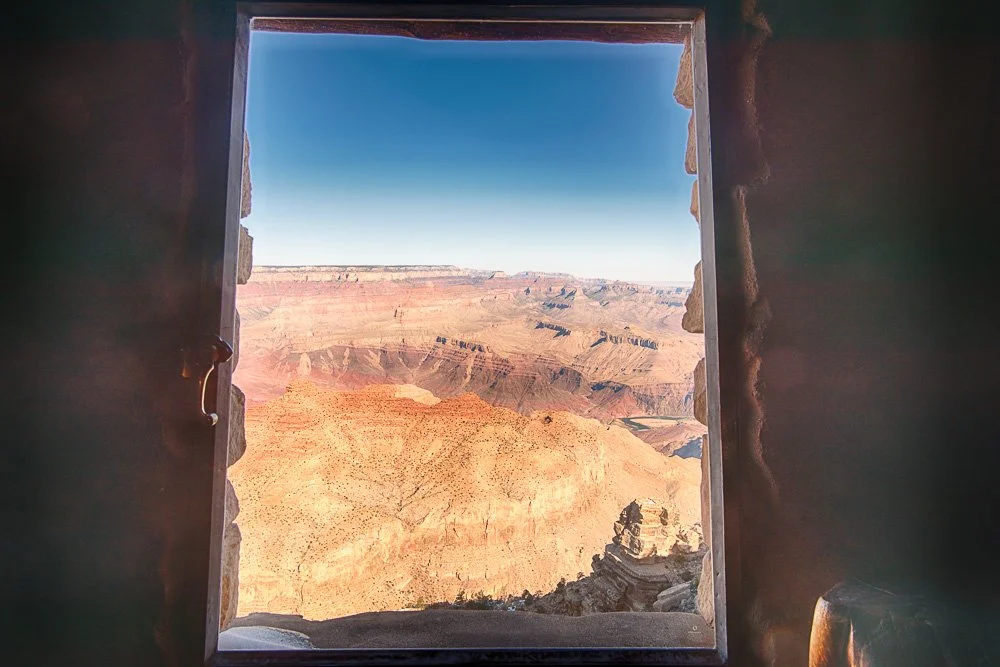
One of the many views from the tower
It was around 10 o’clock now and I reassessed my next steps. Since it was still relatively early in the day, and I really wanted to see the famous buttes at Monument Valley, that’s where I was heading next.
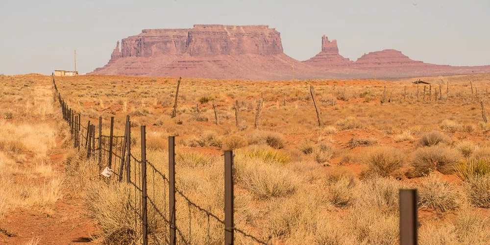
On my way to Monument Valley
Through the Painted Desert it was a pretty drive from the Grand Canyon to Monument Valley. Already I spotted interesting rock formations on the way. I parked my van at the Monument Valley Tribal Park Visitor Center and enjoyed the view of the mitten buttes in the distance. I noticed roads going out between them but they were unpaved and didn’t feel too confident doing that with my loaded van.
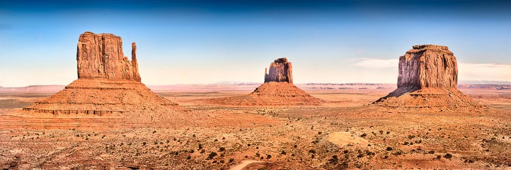
The famous buttes at Monument Valley
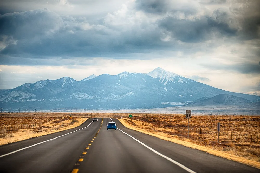
Now it was time to head to Flagstaff. Driving south on AZ-89 I noticed Humphreys Peak in the distance. The pilot from yesterday’s Grand Canyon helicopter ride had pointed it out to us. It is Arizona’s tallest peak with an elevation of 12,633 feet. I stopped to also take a shot of it with the road in the foreground. Nice dark clouds were sculpting the sky.
On the road with Humphrey’s Peak in the distance
When I arrived at my hotel in Flagstaff it started snowing. Little did I know that was the start of a lot of it, which I would learn the next morning.
Roy Kerckhoffs’ Arizona Road Trip 2018 | Day 1
Arizona Road Trip 2018 Day 1
In early 2018 I went on a road trip in Arizona, driving from the Grand Canyon to Tucson, with stops at Monument Valley, Sedona, and Jerome
Day 1
The plan for this week was to attend the Fountain Hills art show in the weekend of February 24th and 25th, then drive to the Grand Canyon on Monday and from there in several days drive to Tucson, where I was supposed to take part in the Tucson street fair the next weekend.
However, I caught the flu a couple of days before Fountain Hills. I felt worse by the day and I just couldn’t stop thinking of having to set up a booth while sick. So I emailed the show organizers and canceled it. Bummer!
Monday
So after being in bed all weekend, on Monday I thought I could pick up my trip from the Grand Canyon. I still didn’t feel 100% but good enough to go on the road and hopefully all better when I’d arrive in Tucson. I hit the road very early, before sunrise. The Grand Canyon is a long drive from Carlsbad, California: almost 9 hours of driving, not counting rest stops.
I’ve driven this route before and I remembered it’s not the most exciting drive. So I’ll skip ahead this part.
I arrived around 2:30pm at my hotel in Grand Canyon Village and checked in. Today, I wanted to take a helicopter ride over the Grand Canyon.
Almost exactly 14 years ago, in February 2004, I visited the Grand Canyon for the first time with my dad. We had taken a helicopter ride over the canyon and I had my Nikon film camera with me. Unfortunately, a couple of days before we left, I had messed up my Nikon D100: I was trying to clean the sensor with a compressed air can and the liquid came out… (my fault, did’t keep the can straight). There were drops all over the sensor and I had sent it in to Nikon. So I was taking photos with rolls of Velvia 50 (positive film).
Later, when I scanned them, it turned out they were not as high-resolution as I’d wished for (wouldn’t have been with the D100 either). Therefore, this felt like another chance for some good aerial Grand Canyon shots with my D800.
I headed over to a nearby helicopter ride company. There was one seat left this day for the next helicopter ride and I paid for it. I get air sick/sea sick/car sick/etc. very easily so I also bought some anti nausea pills at another counter and ate one. Also, I wasn’t quite feeling that great yet, still recovering from the flu. But I had to take those photos!
The helicopter was able to take a large number of passengers (I believe it was 6 or 7) and now I was worried I’d be sitting in the middle. Fortunately I was in the front right, probably the best seat I could wish for.
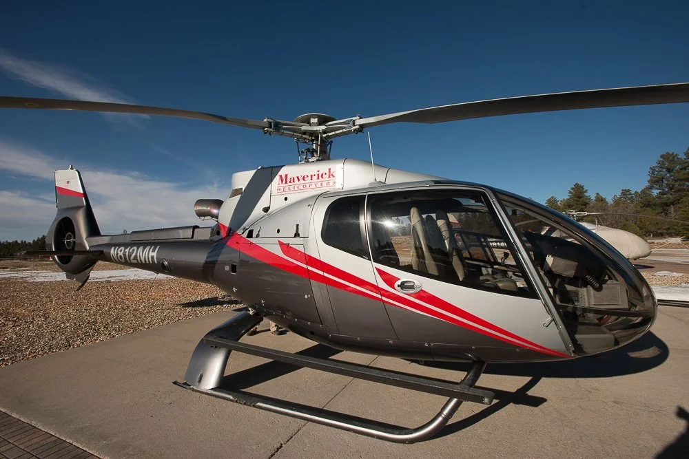
The helicopter for the Grand Canyon tour
We took off. The pilot said they were only allowed to fly towards the Canyon in certain parts as we were flying over the Kaibab National Forest to the east, where he then would turn left and fly over the Canyon. He said that there were lots of animals living in the forest, including deer and bears.
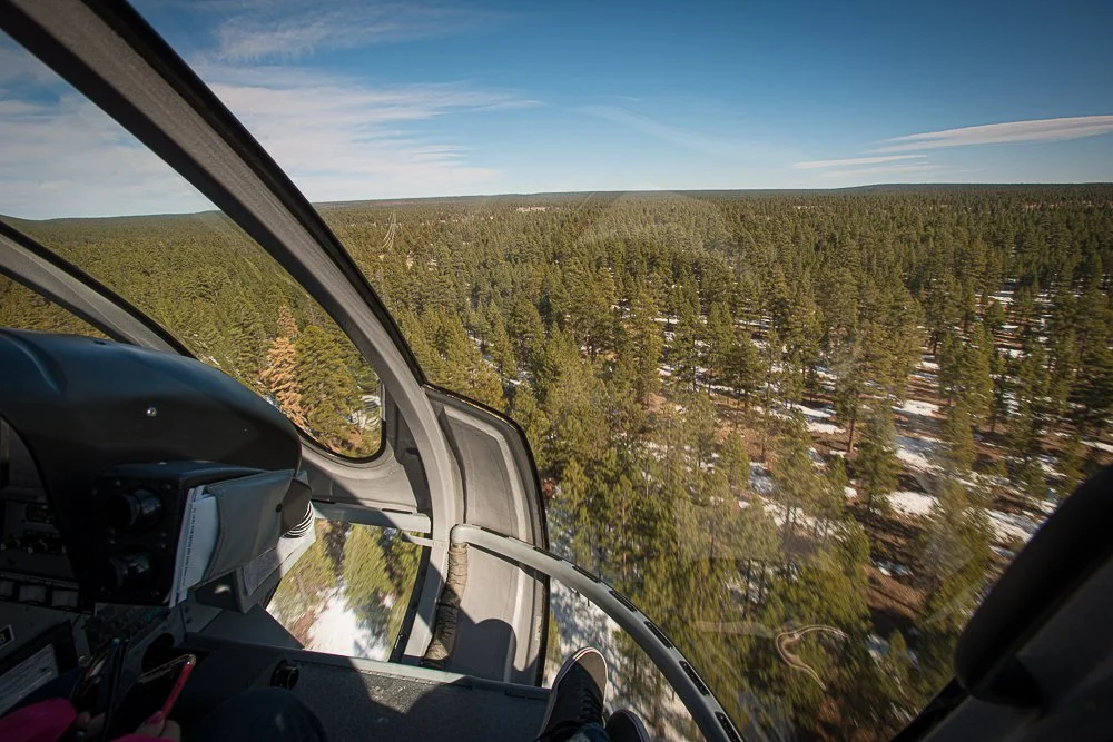
Flying over Kaibab National Forest
He took a left and a couple of minutes later we flew over the south edge of the Grand Canyon, such an awesome view!
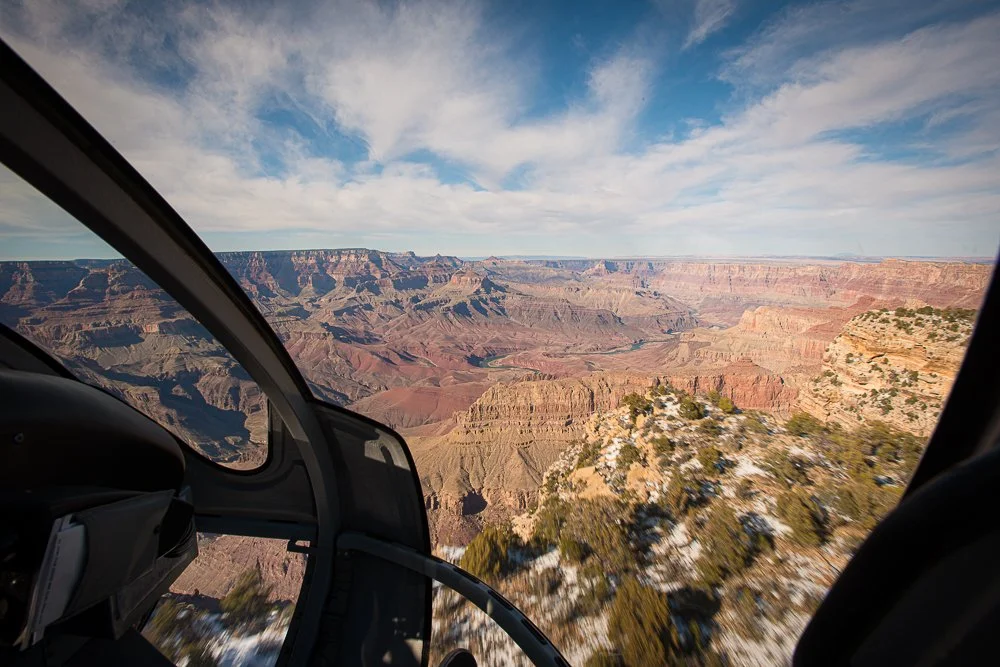
Approaching the Canyon!
I started snapping away, horizontal and vertical shots, trying to keep any helicopter parts out of the viewfinder. I had set the ISO to 100 and the aperture to F/11. While shooting I kept an eye on the shutter speed, making sure it wouldn’t drop too low as the flight was quite bumpy.

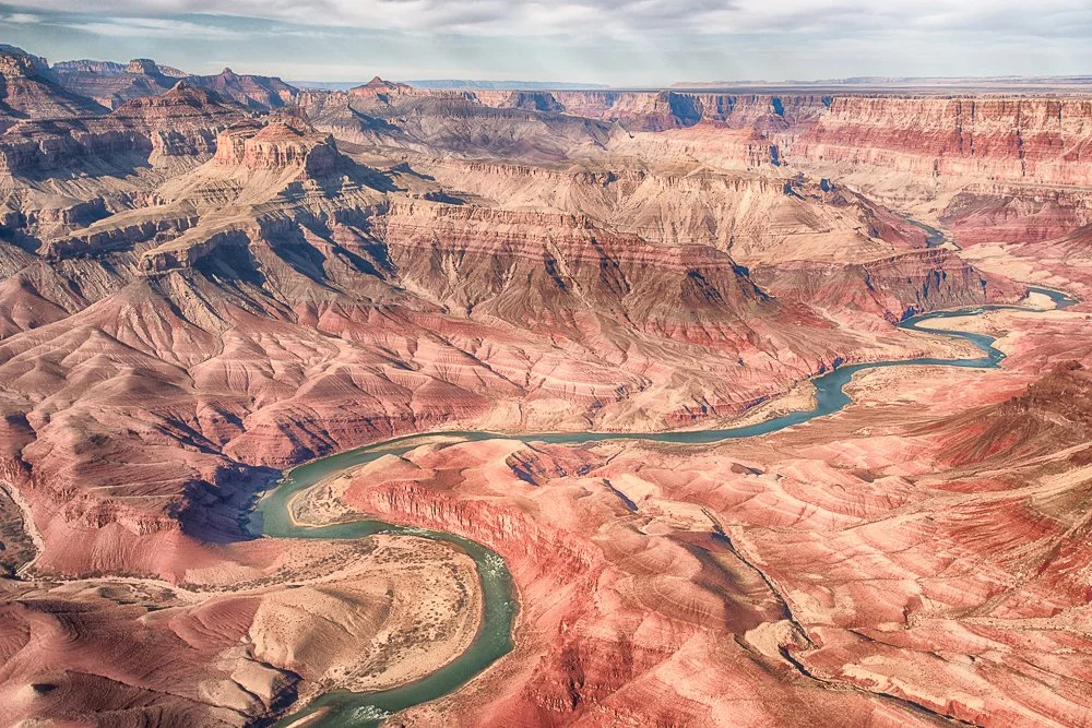
The Colorado River in the Canyon
We flew over the the Colorado river, the Little Colorado River, then turned north.
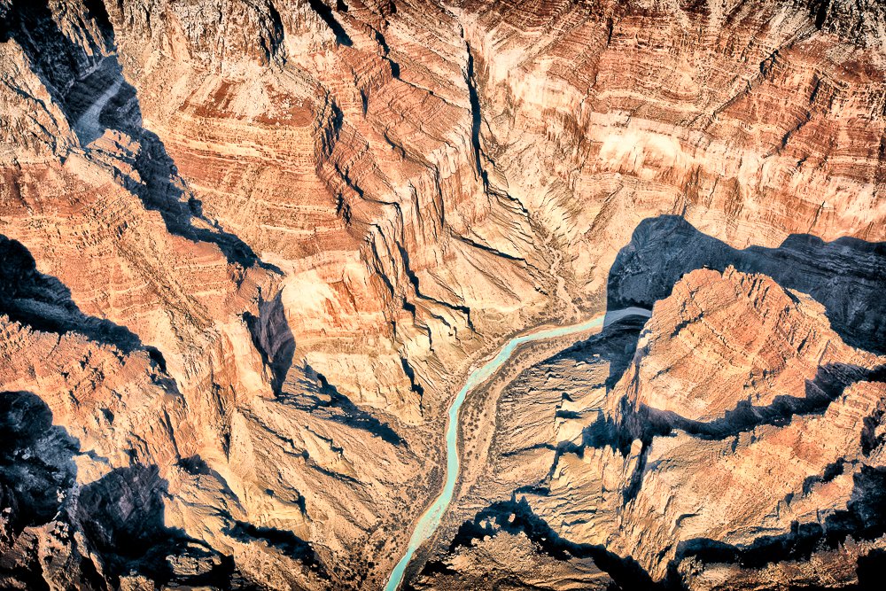
The Little Colorado River
The pilot said that the North Rim is higher than the South one and that we hadn’t increased altitude yet since we flew over the South Rim. Indeed, the North Rim was still peaking out above us.

Snow on the North Rim
We gained altitude and could see the snow-covered forest extending beyond the North Rim.
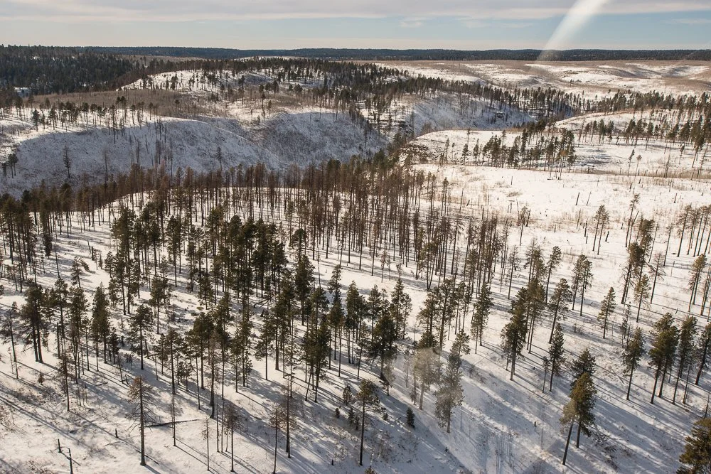
A snow-covered forest at the North Rim
I still felt fine. From there we flew back: the whole flight had lasted about an hour. And the best thing: I didn’t have to throw up! I checked my camera: I had taken 263 photos. Still enough room left on my card to go to drive up to the South Rim and walk around a bit.
I took some more shots from the South Rim, down into the Canyon and also with snow in the foreground.
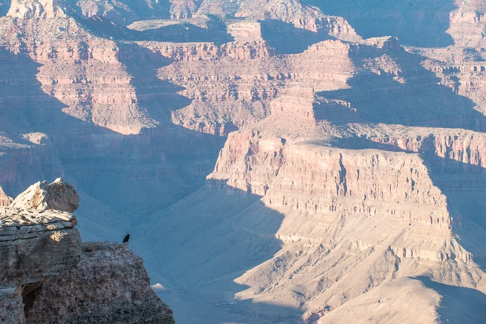
A crow enjoying the view
The sun was getting lower and it was getting very cold now, below freezing.
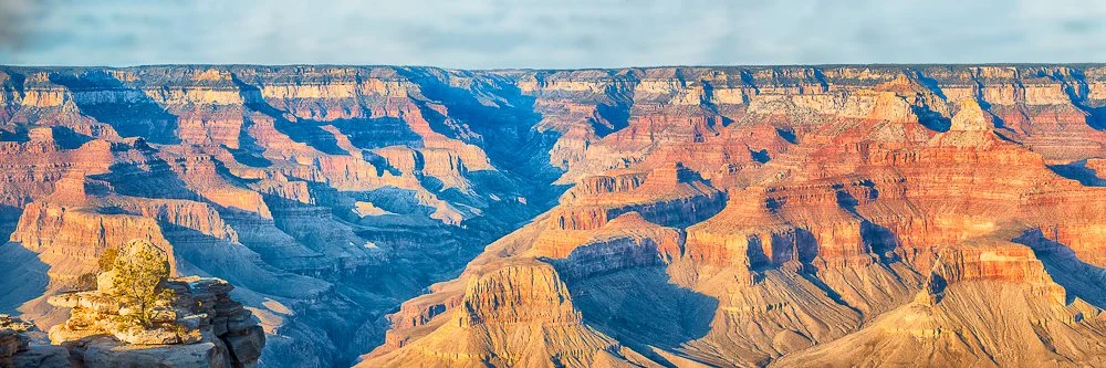
Nice warm and cools
I headed back to the hotel where I grabbed a dinner at the hotel’s restaurant and headed to bed. The plan was to get up early the next morning, drive to the Desert View Watchtower and from there perhaps to Monument Valley? I’d make that decision the next day as I had to figure out if it would all fit time-wise.
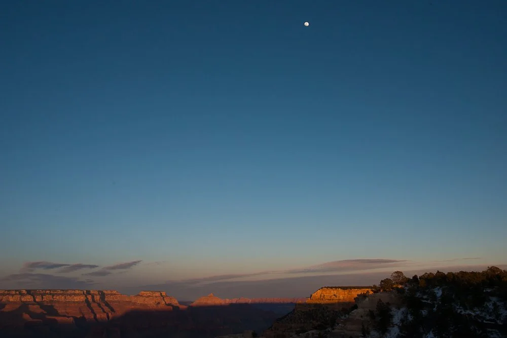
A setting sun and rising moon
This time lapse shows when I hand colored one of my Grand Canyon shots with Marshall Photo Oils on inkjet paper:

A Ghost Story
In September 2016 my wife and I visited the Law's Railroad Museum near Bishop, California. It covers a large area - 11 acres or so. It exhibits the old Laws Railroad station and depot, plus a variety of historic buildings from the late 1800's.
Of the many buildings we visited, one of them was a doctor's office. A guy was sitting on a bench in front of the office. When we were about to enter he said: "It's very creepy in there" to which we responded that we like creepy. Inside, all kinds of surgical tools, medicine bottles, etc. were exhibited from those days.
I didn't have my DSLR with me, and acquired some photos with my iPhone. Suddenly, when I pointed it in a certain direction, my camera app drew the yellow square in the scene; the one that it draws around faces when it recognizes them as such. But there was no one there. Perhaps the random distribution of bottles and cans with labels made the app believe there was a face?
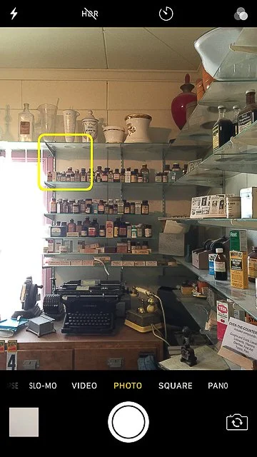
Someone there?
California Road Trip in the Summer of 2018 | Day 8 Part 2
2018 California Road Trip Day 8, part 2
In the summer of 2018 I took my daughter on a 9-day road trip through California. Here is our little story.
Day 8, part 2
We arrived at the King Frederik Inn in Solvang at 3:30pm. Plenty of time to walk around and we didn't have to set up a tent. The inn also had a pool. It was 85 degrees. We facetimed Marie and she guessed correctly where we were. She asked if we could bring chocolate home. We walked around and I took some pics of the town with and without Katie in them. We scouted where we were going to buy the chocolate and ice cream for ourselves on the way back to the hotel later.
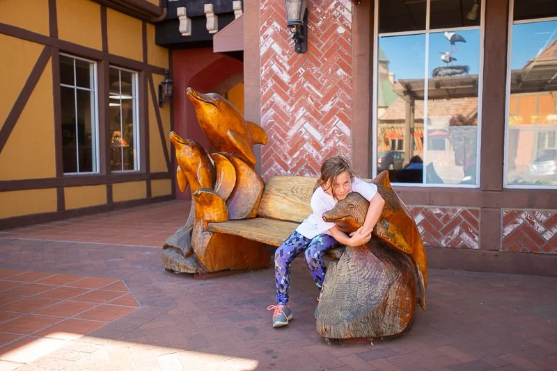
Kate hugging a dolphin sculpture in Solvang, California
When we did so, we entered a little shop that offered both. That shop had a lot of signs posted everywhere which actually gave it a little bit of a negative vibe. "Minimum credit card purchase $5". Okay then. "When your kid reaches under the glass and touches an item, you buy it" and "No loitering. We are a small shop so when you bought something, don't stand in front of our merchandise so new clients can see". Really? When I ordered the ice cream and asked for two spoons I was worried for an instant she would pull out a sign that said "Only one (1) spoon per ice cream cup or cone please". But she didn't.
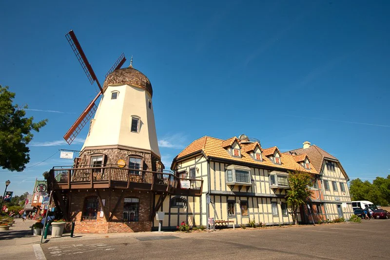
Windmill in Solvang, California
We ate our ice cream on a bench next to a horse drawn carriage. After we finished it we headed back to the hotel and jumped in the pool. We gave each other directions on how to swim. "Using only hands", and "only legs (the duck)", "dog paddle" etc. I told Katie that I wondered what the perfect water temperature is for me to get used to immediately. Even when it's 80 it always feels cold in the beginning. Going into a hot tub of 104 also doesn't feel comfortable, which is the other opposite. So it must be in between. Katie said she thinks it's 90. She may be right as it is probably the temperature of your skin.
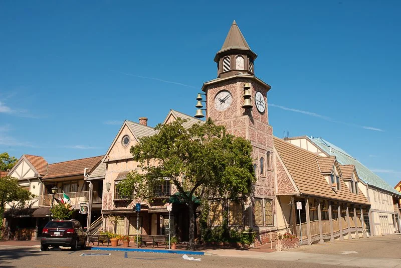
The bell tower in Solvang, California
Later in the evening we had dinner at the Red Viking restaurant, only 2 blocks from our hotel (pretty nice to stay downtown ). Katie read about the history about Solvang on the back of the menu. Among other stuff it said that "Solvang has the best climate yearlong in California ". I said that I thought it was pretty hot today though. She said that it's most likely because of global warming. I said that’s possible because last month again heat records were broken all over the world. She looked worried and asked if there is anything that can be done about it. I told her we should stop burning coal, gas and oil (and derivatives of oil). "Why don't we?", she asked and I said that the people who sell oil, gas and coal don't want to give it up and keep making lots of money from it. They don't care what happens in the future because they won't be alive and only care about here and now". "That is very selfish of them." she said.
The next morning when we stepped outside our room I was a little surprised by all the white and off-white cars in front of the Inn.
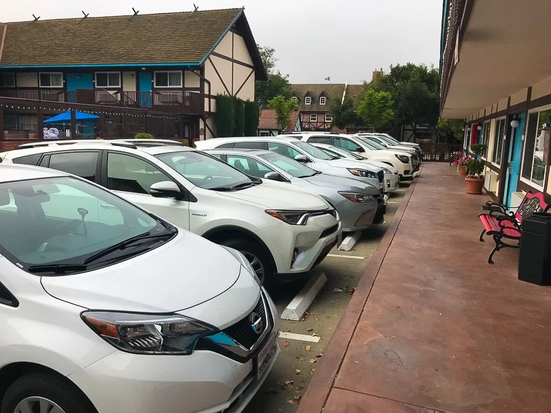
Nothing but white cars in Solvang, California
Arriving back in Carlsbad, Katie and I were happy to see Marie again. We ate some Solvang chocolates and talked about the trip. Katie's favorites were the sea otters in Monterey Bay, the cable car rides and the Exploratorium in San Francisco. Even though I loved the whole trip, if I had to pick my favorites it was (getting ready for) our first camp site, swimming in the river in northern California and also the cable cars.
California Road Trip in the Summer of 2018 | Day 8 Part 1
2018 California Road Trip Day 8, part 1
In the summer of 2018 I took my daughter on a 9-day road trip through California. Here is our little story.
Day 8, part 1
For breakfast we ate two types of cereal from 2 small boxes from a sample kit with milk from the cooler. We put it on two shallow plates so it wasn't the easiest way to eat. We broke up the tent and loaded everything in the car when I noticed that I had locked the car but had left the driver's seat window fully open and my GoPro was stuck on the window. Then I realized it was like that yesterday the whole time when we were at the Aquarium. Oh well, everything was still there and campers are born good, right?
First we headed to a coffee shop to get a latte for me and an ice tea for Katie. I missed the part when "medium latte!" Was announced because a lady stood at the pick up spot and took a picture of the (my) latte. Weird. So I thought it was hers. When I asked whether it was mine and they confirmed I noticed a heart was made in the foam. Still weird though because that was not the first time in the history of the world a barista had performed that art. Ah well, maybe for her it was.
We hit the road again. I decided to skip Big Sur, because we would have to take a big detour after that which would have added many more hours to our trip. I didn't want to drive too far (too many hours) today, so we would have enough beach time or time for something else. I definitely wanted Katie to see the elephant seals north of San Simeon, so I decided to take 101 south, 46 west and 1 north. That would only take 2.5 hours. After that the plan was to find a campground near the ocean in Morro Bay.
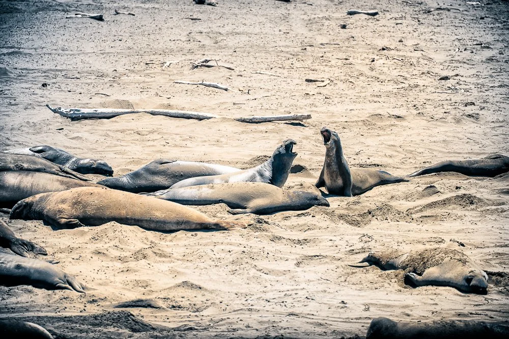
We arrived at the elephant sea vista point and Katie was asleep. Unfortunately she is grouchy most of the time when you wake her up so she wasn't too excited to see the animals. Still, they are quite impressive and two of them were fighting or playing in the ocean. I said "I wonder where the stairs to the beach are so we can pet them". She didn't fall for that and hit me in the tummy.
Elephant Seals near San Simeon, California
It was time for lunch and we headed to Cavalier restaurant.While waiting for the food I looked for a campground near Morro Bay. It was less than 30 minutes of a drive. I asked Katie if she wanted to go to the beach which was a negative. "Would you mind driving a bit more so we have less driving to tomorrow?" Tomorrow we were heading back home. She wouldn't mind another 90 minutes to two hours she said. Me neither so I checked where that would bring us. Solvang! That cute little Danish town. That was only 105 minutes. I checked Priceline and there was one room for a little over $100 in downtown Solvang. Done.
We passed through Morro Bay and Morro Rock was clearly visible. I told Katie that that used to be a volcano and that there are a few more of those more or less in a straight line from each other. They were probably all connected to a huge magma chamber. "What is the difference between magma and lava, daddy?" she asked. I said that they are both molten rock but the only difference is that one is underground and the other above. "Why don't they then just call it the same, either magma or lava all the time?" "I don't know" I replied. "Well, she said, maybe magma is much hotter as it is underground and lava is cooler because it is exposed to air". My little scientist.

Morro Rock in fog
California Road Trip in the Summer of 2018 | Day 7
2018 California Road Trip Day 7
In the summer of 2018 I took my daughter on a 9-day road trip through California. Here is our little story.
Day 7
Today we got up early because the drive to Monterey was going to be almost 4 hours, not counting stops. We ate the cereal we bought yesterday and after that we were on the road at 7:30am. My plan was to follow the CA-1 as much as possible, ignoring Google Maps' directions. I stopped at several locations along the coast to take some pictures, including Jenner and Sonoma Coast State Park. We passed the campground at Bodega Bay - the one we wanted to go to yesterday - with a sign "full ". Good thing we stayed at the lodge.
We drove along Tomales Bay and stopped at Point Reyes Station for a latte and a pastry for Katie and I. While I was walking back to the car I noticed that it said "No Barking" several times on the side of an abandoned building. Somebody changed the "P" in a "B" but it was very well done. I took some shots of it and noticed another photographer doing the same. I walked back to the car but turned around again because I wanted a parked car in front of it in the same shot.
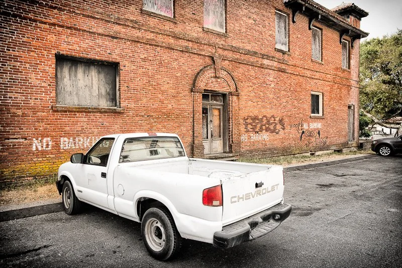
As long as there is no barking dog in this pick-up, rules are being followed
Near Stinson Beach we stopped to look at a hundred or so seals resting on the sand. There were a few pups too. Here we ate our pastries. Instead of following the 1 all the way I took the Panoramic Highway which runs through Mount Tamalpais State Park. It is a very dense beautiful forest and I recorded part of the way with the GoPro on the windshield. We reached the 101 and while going over the Golden Gate Bridge I ran the GoPro again. Now we were going straight through San Francisco which slowed us down a bit.
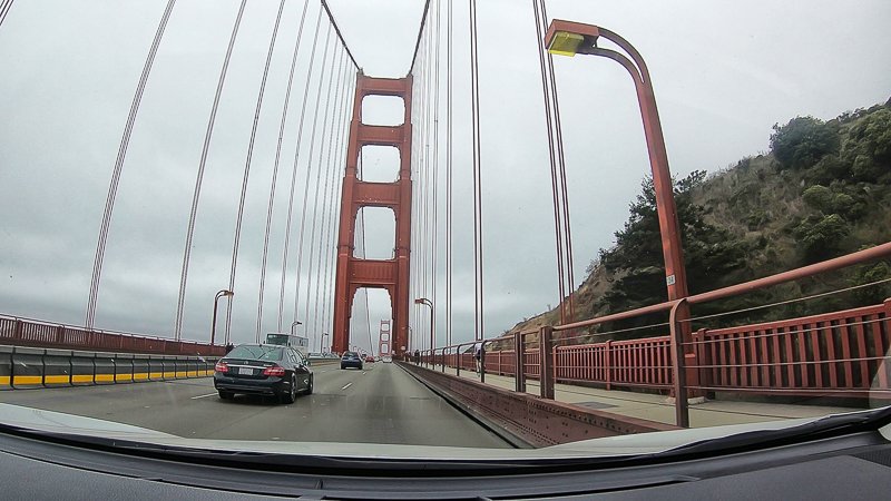
Going over the Golden Gate Bridge with the GoPro
The rest of the way was pretty eventless and we reached the campground at Veterans Memorial Park around 1:30pm. I was worried it also would be full, but fortunately there were lots of vacancies. Later an Uber driver told us it's a little known campground. Another driver had never heard of it. We picked our spot and self-reserved it. We set up the tent, locked the car and summoned an Uber to go to the Monterey Bay Aquarium. I accidentally put the pin in a wrong location for the Uber driver to pick us up. She then called me to confirm where I was. Katie said: "You do realize now, daddy, that she will probably rate you either 3 or 4 stars?"
On the way to the aquarium we chatted about our California road trip. The driver asked us if we had been to the Ice Cream Museum in San Francisco. We hadn't and she told us how fun it is. So that is on our list for our next visit to SF. When we exited the car Katie said "Okay I think she will rate you probably 4 stars".
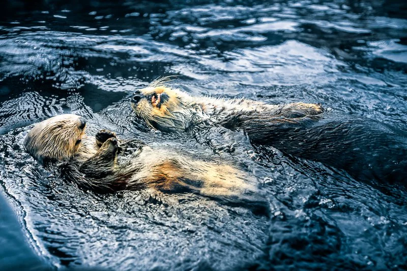
It was super busy at the aquarium. I told Katie that if we would get separated, she should go to an aquarium employee and call me. The penguin feeding was coming up but it was just too busy so we went to the sea otters first. She loved those! They are indeed very cute and very difficult to take good photos of. We ended up 2 times more at the sea otter exhibit. She asked if I could print and frame one of my sea otter shots to put in her room. At the bat ray exhibit she didn't want to pet them. I loved the big aquarium that is 3 stories high with lots of kelp and local fauna in it, such as leopard sharks, garibaldi and an enormous sea bass, of whom I took a video and some photos because he/she came right around the corner close to the glass. The octopus was also active and impressive.
Sea Otters at the Monterey Aquarium
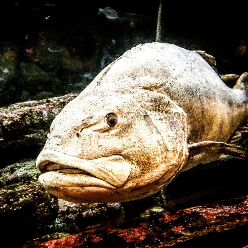
A big Sea Bass at the Monterey Aquarium
We then had dinner along the coast and ubered back to the campground. The driver told us that all the water (except the water used in tropical exhibits) is pumped from the ocean, used in the exhibits and pumped back. The aquarium also grows their own kelp.
Back at the campground we both ended the day drawing. Katie drew an exhibit where dogs, cats and sea otters live together whereas I drew a little tree next to our campsite. We went to sleep when it started to get dark.
California Road Trip in the Summer of 2018 | Day 6
2018 California Road Trip Day 6
In the summer of 2018 I took my daughter on a 9-day road trip through California. Here is our little story.
Day 6
Last night I slept well. I had brought some ear plugs so any noise would be canceled out. Yes, even leaves falling on the tent will wake me up. Not this night though. We broke down our tent at around 8:30am and hit the road again. First we stopped at a wooden pedestrian bridge which was only less than 5 minutes away.
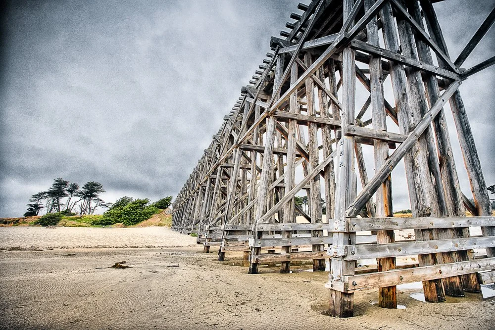
A wooden pedestrian bridge near the Pacific
When I parked the car Katie asked if she could stay in the car and play on the iPad. No. Way. It was another beautiful overcast day - with a little bit of drizzle - a few steps from the ocean (and an interesting Bridge that went over a river flowing into the ocean). All grouchy she stepped out. There were geese in the river. I walked to the bridge and took some pictures. There were steep cliffs on the far side of the river and beach sand on this side. I was walking where the sand was lower, almost level with the river when it got very mushy when I stepped on it. Quicksand! Or, at least it seemed to be a mild version of it. Katie came to check it out too. "Look daddy, there are dog prints here and they stop there". "That's because it's quicksand and the dog is under it right there", I said. "Stop it daddy!”, she replied.
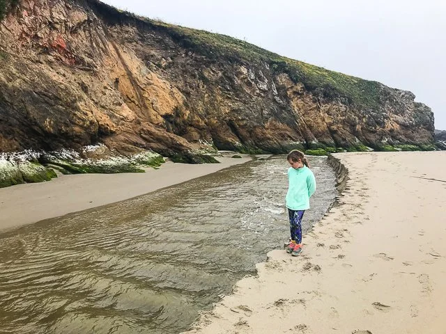
Katie checking out the small river
We facetimed Marie as it was one of the rare places with reception. "Where are you going to have breakfast?" she asked Katie. "Daddy wants to go Denny's". Well, it was right on our route back to Glass Beach where Katie wanted to collect some more sea glass. So we did. The coffee was not great as expected. Katie wanted a parfait but that was not available. I told her that the plan now was as follows: "1. Go to Glass Beach; 2. Get gas for the car; 3. Go to Starbucks for a parfait; 4. Leave for a hotel/motel/campground and stop anywhere at something interesting on the way".
So back to Glass Beach. While she was collecting, I tried to find lodging near Bodega Bay for the coming night but there was no reception. I noticed a spoon sticking out of a big rock and realized that was not a rock, and most of the "rock" around us was not rock. This must have been an old dump a long time ago, hence the sea glass.
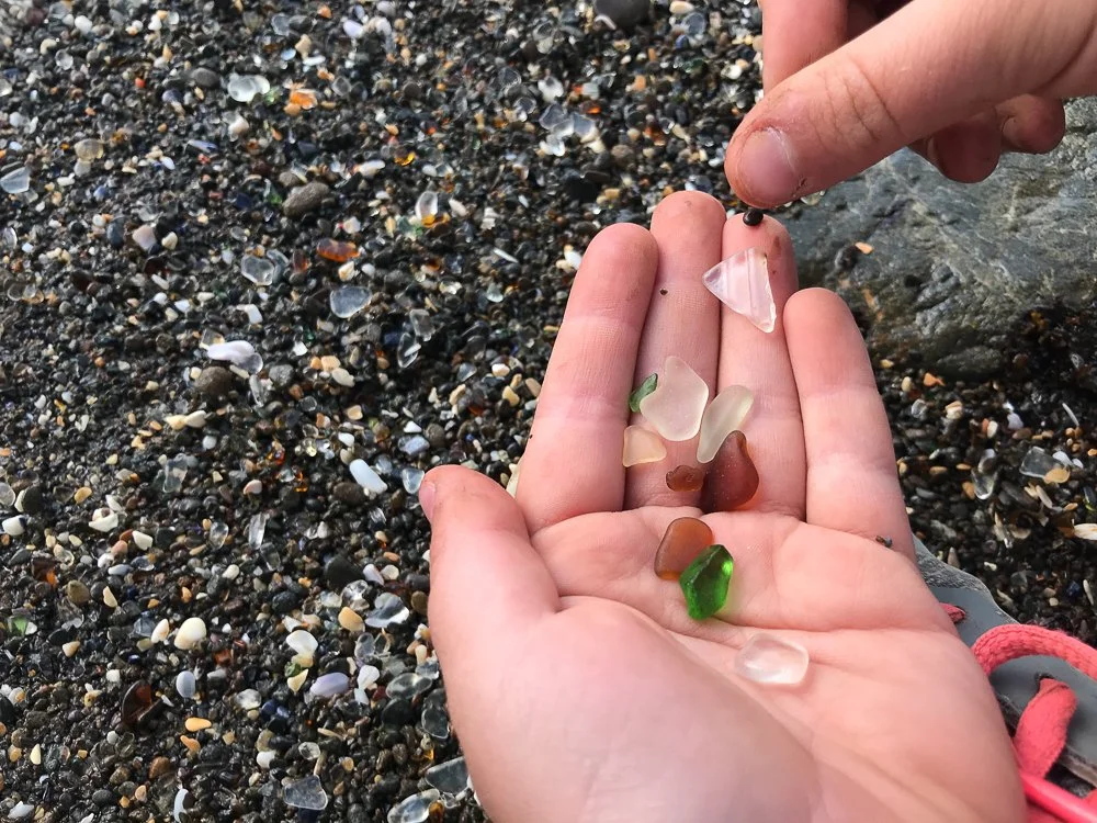
Katie holding pieces of colorful sea glass
After we were done here I gassed up the car and headed to the only Starbucks in a 1000 or so mile radius. I bought a parfait for Katie and for myself a latte. While we were sitting down I tried to find a place to sleep. All lodging around Bodega Bay was either not available or a minimum two night stay or $2000 per night with 3 night minimum (whereas I was kidding with the 1000 mile, not so with this one). Hmmm, I chose a campground on Google Maps and hoped for the best. It was a 2.5 hour drive. I put the GoPro on the windshield again to get some recordings of the drive.
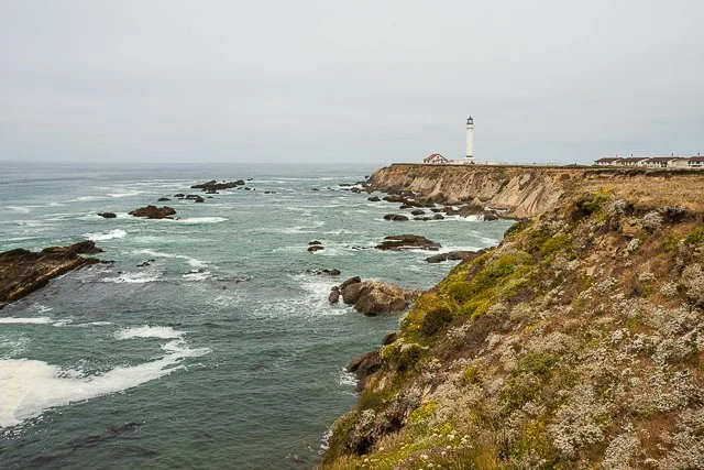
Our first stop was at the Point Arena Lighthouse. I got some shots from a distance with two different lenses. It was a beautiful coast line which I also wanted in the shots. We walked to it andlooked around. I didn't feel like going to the top of the tower which was a possibility. Fortunately Katie didn't want to either.
On our way to the Point Arena Lighthouse.
Around 2pm we felt it was time for lunch and I pulled over to look for something. Only 1 mile ahead was Black Point Grill at Sea Ranch Lodge and we went for it. Beautiful photos of local scenery decorated the walls. The view from the restaurant was also amazing and I spotted a sea lion in the ocean. The campground was still a little over an hour away.
After 20 minutes or so of driving I thought we could probably already look for a place to stay. It would only add 45 minutes to our drive tomorrow. The next day I wanted to make it to Monterey on time to go to the Aquarium. We approached a campground. "Full", a sign told us. Another campground. Also full. The next one, also full. Then we reached Timber Lodge. Built on the cliffs with magnificent views I was afraid it was either full too or too expensive. "What shall we put our dollar limit on, Katie?" "That's your call, daddy." Oh yes it is so I picked an almost random number of $300 before we walked up to the reception. "We have only one room left with bunk beds and it's $399 before taxes." the lady said. "Hmm, we just put our limit at $300" I told her. "Let me talk to the manager and see what we can do". She came back after 5 minutes and said they could offer it for $330. "Thank you but no thank you, that's still too much". I said. Then she said that a place called "Fort Ross Lodge" is a mile further down the road and after that nothing for miles.
We found it easily and entered the reception building. "Do you still have availability for one night and if so how much is it?" I asked. "We have one room left and it is $240", the guy replied. "We'll take it", I said. I felt so lucky. According to Priceline there were motels available in Santa Rosa but I didn't want to go that far from our path. The lodge turned out to consist of cozy cabins lookingout over the ocean with a hot tub.
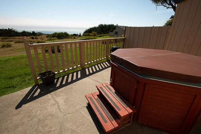
The hot tub at our cabin
I was thinking what to do for dinner later. The receptionist had mentioned that we could barbecue and that there is a little shop across the street which closes at 6pm. It was 4 now. Or, he said, the lodge one mile north of here (the one we came from earlier) has a restaurant. I thought we would go to the restaurant because we didn't have charcoal. Katie and I played soccer behind our cabin in the big open field.
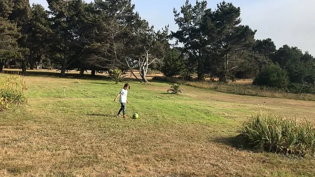
Katie and I playing soccer behind our cabin
I was ready to go to the store across the street after I was downloading some videos from my GoPro onto my iPhone when Katie said "Why does this clock here say it's 6:10?" And was holding her hand in front of it. I laughed and said "You heard what the receptionist had said, didn't you!" Then she laughed and said "I pay attention when you don't expect it, daddy". We went to the store and saw that the lodge offered charcoal so I changed my plan. "Let's barbecue at the cabin so we don't have to drive anymore". "I'm all for it!" Katie said. We also bought some cereal and milk so we could also have breakfast at the cabin the next morning.
It took some time to get the barbecue going, but in the end it all worked and we had a good self-made meal. I told Katie we would go to sleep early so we could leave on time to go to Monterey.
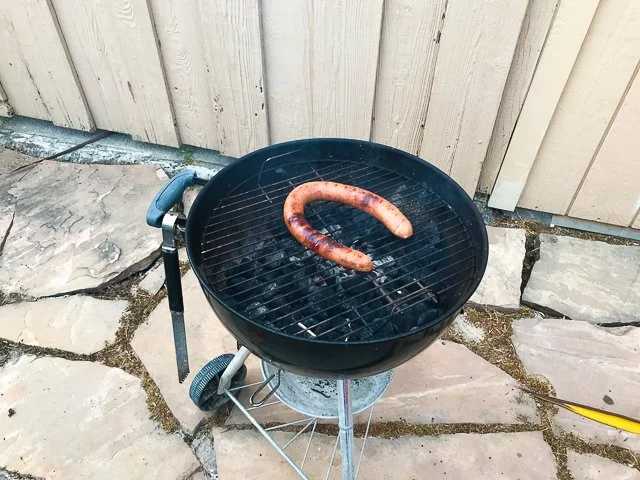
And our barbecue at the end of our day
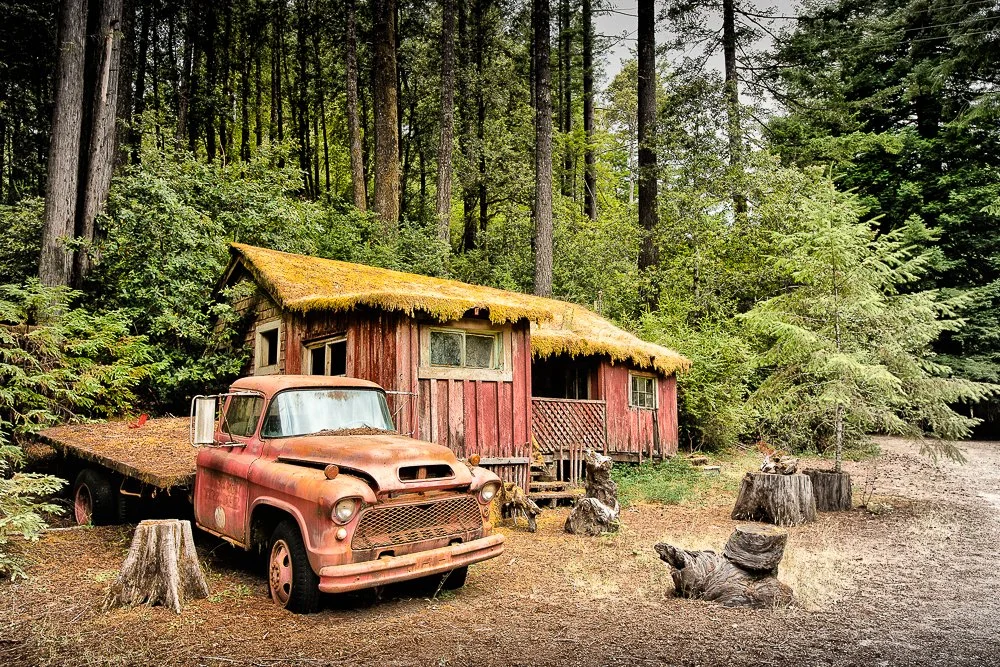
California Road Trip in the Summer of 2018 | Day 5
2018 California Road Trip Day 5
Day 5
After breaking up our camp ground we started the day with a hike along Bull Creek. We took the Avenue of the Giants to get there and I'd put my GoPro on the car's windshield on the way there. We parked at Rockefeller Loop. Katie said she was a little worried to run into bobcats (but it was really mountain lions she meant). When we got to the creek we noticed a large tree that had fallen down over it and wasn't touching the ground on our side. Katie climbed on it and said she wanted to walk over it to the other side but I couldn't let her do it. At the other end it was about 15 feet above the ground (with pebbles and a shallow bit of water underneath).
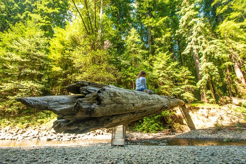
Kate on the suspended log
We walked back to the trail enjoying the giant trees. She had a little stick with her (about 1/4" thick and a foot long) which she would wave above her head if we would encounter a bobcat. At some point she started to hit the stick rhythmically on a log and I had to guess which song it was, which I didn't know. She said it's the Puffy (our dog) song which goes like "Dancing on those paws, dancing dancing on those paws, with that fur, with those eyes, with that snout, let's have some fuuuun". Later she said that it's not particularly related to Puffy but that it's an ode to all dogs.
We walked back to the car and were ready for our 2 hour drive to the MacKerricher Westpine Campground near Fort Bragg. The first part we traveled the 101 South and the last half or so the California 1. The first part of the 1 was also through redwoods. Katie was asleep when I noticed some abandoned houses at Hales Grove. Old trucks were sitting next to them and one house had a rusting tricycle sitting in front of it. I drove past by it but I couldn’t let it go, so I turned around a couple of minutes later so I could get some shots.
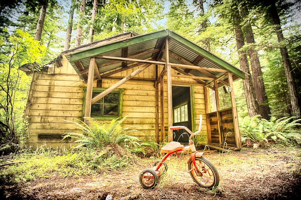
An abandoned tricycle at an abandoned cabin
Everything abandoned at Hales Grove
Check out my YouTube video when I colored the 1955 Chevy:
A little while later we arrived at the ocean. It was going to be our companion for the next few days. The coast looks so different up there with all the tall cliffs and the rocks sticking out of the water.
When we arrived at the campground, I asked the host if he had any vacancies. He said he didn't know as he was only the host. I would have to drive around and look for a campsite sign with no tags on them. Katie was helping looking out. Everything was taken. A little disappointed we drove to the state kiosk and asked the ranger. He said they had only one spot left and we should make sure it hadn't been claimed yet. If not we had to go back and pay for it. We headed to it and indeed it was empty. I claimed it by putting our tent bag on a post. After paying for it back at the kiosk I asked the lady what the temperature of the ocean is. She looked funny at me and said "Way too cold". "Oh, we're from San Diego" I said. "It's not like that here at all”, she replied. Later I saw a sign near the ocean that said that the water is "deadly cold".
We set up our camp again and played soccer at our campsite. Next we headed to Fort Bragg to buy more s'more ingredients, firewood starters, water and ice. On our way back to camp I noticed a sign "glass beach". As expected, it was a beach with lots of sea glass and Katie loved it. She collected some. She face-timed Marie to tell her all about it and show the pieces. Back at camp I parked the car and we walked to a Mexican restaurant down the road so I could have a margarita. After we had our dinner we made our own dessert at camp (you guessed it, s'mores). Katie said this was my best fire so far. "Probably because of the free wood", she said, as there were a few intact logs in the pit when we arrived.